                |                |
Monday, October 15, 2012

The Sand Cave and White Rocks are two of my favorite hiking destinations, it just so happens they are on the same trail. The Ewing Trail leaves the Thomas Walker Civic Park near Ewing, Virginia and ascends the mountain on a 9.5 mile loop, for the average hiker it's strenuous, for beginners, it's downright awful.
The beginner is where Brock and Brandon come into play. I met them while training in Rogersville, Tennessee and after finding out about my obsession with hiking, they volunteered to go with me. We haggled somewhat on a location and our schedules clashed on more than one occasion, but the Sand Cave/White Rocks hike eventually found itself at the top of the heap.
This past Sunday we decided we needed a prep hike for Tuesday's grueling journey. We visited Elrod Falls in Sneedville, TN, which is a cheap easy stroll to a couple of really nice waterfalls. We left from work so Brock and Brandon were able to go home and change while I had to keep my shirt and tie on, along with some slick bottom dress shoes. The trail is level until reaching a sloped rock angled toward the creek about 15 feet below. There are several ways to navigate this, you can climb around it taking a higher worn trail and descend the opposite side, you can scramble down to creek level and rock hop around it's base, or you can be a man and cross it using the few cracks and holds on the rock itself. I opted for the creek level due to my shoes and Brandon was next to cross, with his first step his feet flew out and he slide violently down the rock splashing in the creek up over his knees. Our first hike was two minutes in and we had already experienced "epic failure" Brock and I laughed hysterically almost resulting in Brock joining Brandon with the same fate. After we composed ourselves, I decided to shed my shoes and hike barefoot. I wished someone else could have come along and seen me in my dress clothes with my pants rolled up climbing up the trail to the second falls, it was funny looking I'm sure. After we hiked we all were pretty excited for Tuesday and what new laughs we would have.
So Tuesday morning, we met in Rogersville and took highway 70 to Jonesville arriving at the civic park around 10am. We all had packs with various goodies and set off on the trail excited to get to the Sand Cave. The first mile of trail winds gently up the mountain crossing the creek several times. Eventually you arrive at a registration box, so the park service can monitor how many people visit and an idea of where to look if something goes wrong. From here the trail climbs fiercely alongside a creek for about half a mile. Brandon and Brock struggled but laughed it off marveling at how their legs were already burning. We rested briefly before busting out a mile and a half straight of switchback climbing. I was really impressed with their pace and determination, this was not where I would want to be taking my first hike. At a sharp curve in the trail there is a nice rock for resting and we took a break here, enjoying the views and our progress so far. The next mile and a half is relatively uneventful and crosses the mountain summit. I could see the relief on both their faces that we had the majority of climbing behind us. As the trail declines the back side of the mountain to Sand Cave the vegetation changes drastically and the trail becomes more and more sand covered.Upon arrival at the cave, Brock and Brandon found their strength again. We explored briefly before deciding to have lunch next to a nice waterfall flowing over the top of the cave. I think I ate some of the strangest combinations I've ever had but I had to pass on the barbeque vienna sausages Brock brought. Afterwards we made our way into the cave which is no easy chore. The grade is steep and the sand is deep, it's a real workout to get to the back walls of the cave where the sand is less deep and more footing is to be found. I was really pumped by how much they were enjoying it and we scurried all about the cave pointing out each of our findings.
We spent about thirty minutes in the cave before hiking the spur trail out and heading on to White Rocks. The climb is steep and our legs were tired but the promise of great views and fall colors drove us on. They both were impressed when we arrived at the large crack in the base of White Rocks that serves as the route to the top. I was the first to make it to the top and I watched the looks on their faces as they came into the open, high in the heavens. Brock in particular loved the White Rocks, he ran about like a small child and found bravery that I, nor anyone else I've brought there, has demonstrated. Brandon also eased out to the edge a few times marveling at the height and of how many times you could scream before splattering on the rocks below if you were to fall. Most of my visits to White Rocks are brief and I have never really explored but we found some other nice views along the towering cliffs and some tough climbing over large boulders. Brock found a sheer drop of at least 600 feet, my head swam as I scooted out to peek over and the distance was so great that my camera couldn't focus when I held it out for a straight down shot. We made our way back to our packs and enjoyed another round of snacks. They both agreed the tough climb had been well worth it and already talked of when they would come back again. I sat and enjoyed the view with a smile on my face, knowing I had found two new hiking partners. Until next time...happy trails!

 |
| The Sand Cave |
 |
| Brock and Brandon victorious in the cave |
The beginner is where Brock and Brandon come into play. I met them while training in Rogersville, Tennessee and after finding out about my obsession with hiking, they volunteered to go with me. We haggled somewhat on a location and our schedules clashed on more than one occasion, but the Sand Cave/White Rocks hike eventually found itself at the top of the heap.
 |
| heading in the entrance |
 |
| The waterfall just outside the cave |
This past Sunday we decided we needed a prep hike for Tuesday's grueling journey. We visited Elrod Falls in Sneedville, TN, which is a cheap easy stroll to a couple of really nice waterfalls. We left from work so Brock and Brandon were able to go home and change while I had to keep my shirt and tie on, along with some slick bottom dress shoes. The trail is level until reaching a sloped rock angled toward the creek about 15 feet below. There are several ways to navigate this, you can climb around it taking a higher worn trail and descend the opposite side, you can scramble down to creek level and rock hop around it's base, or you can be a man and cross it using the few cracks and holds on the rock itself. I opted for the creek level due to my shoes and Brandon was next to cross, with his first step his feet flew out and he slide violently down the rock splashing in the creek up over his knees. Our first hike was two minutes in and we had already experienced "epic failure" Brock and I laughed hysterically almost resulting in Brock joining Brandon with the same fate. After we composed ourselves, I decided to shed my shoes and hike barefoot. I wished someone else could have come along and seen me in my dress clothes with my pants rolled up climbing up the trail to the second falls, it was funny looking I'm sure. After we hiked we all were pretty excited for Tuesday and what new laughs we would have.
 |
| first view of the fall colors at White Rocks |
 |
| The thought of returning to work almost made me jump |
 |
| another successful hike |
So Tuesday morning, we met in Rogersville and took highway 70 to Jonesville arriving at the civic park around 10am. We all had packs with various goodies and set off on the trail excited to get to the Sand Cave. The first mile of trail winds gently up the mountain crossing the creek several times. Eventually you arrive at a registration box, so the park service can monitor how many people visit and an idea of where to look if something goes wrong. From here the trail climbs fiercely alongside a creek for about half a mile. Brandon and Brock struggled but laughed it off marveling at how their legs were already burning. We rested briefly before busting out a mile and a half straight of switchback climbing. I was really impressed with their pace and determination, this was not where I would want to be taking my first hike. At a sharp curve in the trail there is a nice rock for resting and we took a break here, enjoying the views and our progress so far. The next mile and a half is relatively uneventful and crosses the mountain summit. I could see the relief on both their faces that we had the majority of climbing behind us. As the trail declines the back side of the mountain to Sand Cave the vegetation changes drastically and the trail becomes more and more sand covered.Upon arrival at the cave, Brock and Brandon found their strength again. We explored briefly before deciding to have lunch next to a nice waterfall flowing over the top of the cave. I think I ate some of the strangest combinations I've ever had but I had to pass on the barbeque vienna sausages Brock brought. Afterwards we made our way into the cave which is no easy chore. The grade is steep and the sand is deep, it's a real workout to get to the back walls of the cave where the sand is less deep and more footing is to be found. I was really pumped by how much they were enjoying it and we scurried all about the cave pointing out each of our findings.
 |
| my favorite pic of the cliffs |
 |
| Loose boulders balanced along the cliffs edge |
We spent about thirty minutes in the cave before hiking the spur trail out and heading on to White Rocks. The climb is steep and our legs were tired but the promise of great views and fall colors drove us on. They both were impressed when we arrived at the large crack in the base of White Rocks that serves as the route to the top. I was the first to make it to the top and I watched the looks on their faces as they came into the open, high in the heavens. Brock in particular loved the White Rocks, he ran about like a small child and found bravery that I, nor anyone else I've brought there, has demonstrated. Brandon also eased out to the edge a few times marveling at the height and of how many times you could scream before splattering on the rocks below if you were to fall. Most of my visits to White Rocks are brief and I have never really explored but we found some other nice views along the towering cliffs and some tough climbing over large boulders. Brock found a sheer drop of at least 600 feet, my head swam as I scooted out to peek over and the distance was so great that my camera couldn't focus when I held it out for a straight down shot. We made our way back to our packs and enjoyed another round of snacks. They both agreed the tough climb had been well worth it and already talked of when they would come back again. I sat and enjoyed the view with a smile on my face, knowing I had found two new hiking partners. Until next time...happy trails!
 |
| I estimated this to be about 600 feet. |
 |
| Anything for a funny photo |

Monday, October 1, 2012
First of all, let me apologize to all my followers or casual readers of this blog. It has been a long time since my last update and with good reason, on the hike to Hump Mountain, I injured my toe and have been sidelined since then waiting on the nail to work loose and get back on the trail.
Yesterday, I visited the Grayson Highlands in Virginia, they are home to the highest peak in the state, Mt. Rogers and also to a pack of "wild" ponies. Wild is a stretch really, the ponies live in the high country to maintain the balds and pasture like appearance but they are fenced in. However, they live off the land and have no form of shelter, the only intervention by humans is the hikers feeding them, which has several of them completely tame and downright annoying.

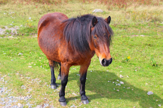

The main entrance to the park is located between Damascus and Volney on US 58. The road is curvy and if you get car sick easy, the road will make you miserable. There is a small entrance fee of $3 and the road takes you to the top of the mountain arriving at the Massie Gap parking lot. I had read the maps over the few days before we went and the information online is sketchy and confusing. I had brought Steve and Pauline with me and we settled on parking at the place with the most cars, Massie Gap. From the parking lot, there are several trail heads to choose from and we took the Rhododendron Gap Trail across Wilburn's Ridge toward the AT intersection that takes you on to the summit of Mt. Rogers. The interesting thing about Mt. Rogers is that it's the highest peak east of South Dakota that doesn't have a road to it's summit. It's also a tree covered summit eliminating the beautiful views. I was just interested in finding the ponies and as I hiked across Wilburn's ridge not even half a mile from the parking lot in the middle of the trail stood a pony! I was immediately transformed into a giggling child and approached the pony to see how close I could get, the pony stood still and allowed me to rub his mane and leaned into each stroke encouraging more petting. Just up the trail was a group of at least ten more ponies and several people were just hanging out and taking pictures. The ponies were all different colors and all seemed to be really tame, several would approach and nudge at your pockets looking for snacks and one even took a bite at my leg. We all loved the ponies and spent some time with the herd taking pictures and just watching them before moving on toward a large set of rocks that could be climbed up the ridge.

The trail wound around the pasture and arrived at the base of the boulders, they rose at least 30ft above the surrounding landscape and worn spots in the rock made it an easy climb up and around to their summit. The views were indeed spectacular and as I surveyed our surroundings a large peak loomed across the parking lot rising even higher than where we were. We decided to head back to the truck and go summit what we found on the map as Big Pinnacle. We parked at the gift shop and the trail head for the twin pinnacles starts behind it. The trail is a 1.6 mile loop taking you on a graded hike through the woods to Little Pinnacle and Big Pinnacle. The Little Pinnacle overlook is a short half mile from the gift shop and at 5089 feet, is actually higher than Big Pinnacle by about twenty feet. However, the Big Pinnacle has better views and the rock outcrop ends abruptly with a towering cliff and certain death if you were to slip (awesome!) Pauline had noted a waterfall on the trail map so as the day was coming to a close we decided to squeeze in the waterfall on Cabin Creek before calling it a day.


The trail for Cabin Creek begins at the Massie Gap parking lot too, and slops downhill for .6 miles before arriving at Cabin Creek. Steve immediately found several trout in the creek and a short hike upstream and you arrive at a double 25ft waterfall. I thought it was nice and surprisingly we had it to ourselves, it photographs really well due to the shade and the flow is powerful also. Steve and I rested and Pauline explored.

I was overwhelmed by the day and kicked myself for overlooking such a stellar park. All the trails were easy and family friendly, the Pony interaction was definitely a highlight, and the views were second to none. I will visit this park for years to come and recommend you do the same. Hopefully my toes will stay intact and I can bust out some hikes now that leaf season is upon us, until next time...happy trails.


 |
| Fall arrives at the Grayson Highlands. |
 |
| beautiful fall colors |
Yesterday, I visited the Grayson Highlands in Virginia, they are home to the highest peak in the state, Mt. Rogers and also to a pack of "wild" ponies. Wild is a stretch really, the ponies live in the high country to maintain the balds and pasture like appearance but they are fenced in. However, they live off the land and have no form of shelter, the only intervention by humans is the hikers feeding them, which has several of them completely tame and downright annoying.


The main entrance to the park is located between Damascus and Volney on US 58. The road is curvy and if you get car sick easy, the road will make you miserable. There is a small entrance fee of $3 and the road takes you to the top of the mountain arriving at the Massie Gap parking lot. I had read the maps over the few days before we went and the information online is sketchy and confusing. I had brought Steve and Pauline with me and we settled on parking at the place with the most cars, Massie Gap. From the parking lot, there are several trail heads to choose from and we took the Rhododendron Gap Trail across Wilburn's Ridge toward the AT intersection that takes you on to the summit of Mt. Rogers. The interesting thing about Mt. Rogers is that it's the highest peak east of South Dakota that doesn't have a road to it's summit. It's also a tree covered summit eliminating the beautiful views. I was just interested in finding the ponies and as I hiked across Wilburn's ridge not even half a mile from the parking lot in the middle of the trail stood a pony! I was immediately transformed into a giggling child and approached the pony to see how close I could get, the pony stood still and allowed me to rub his mane and leaned into each stroke encouraging more petting. Just up the trail was a group of at least ten more ponies and several people were just hanging out and taking pictures. The ponies were all different colors and all seemed to be really tame, several would approach and nudge at your pockets looking for snacks and one even took a bite at my leg. We all loved the ponies and spent some time with the herd taking pictures and just watching them before moving on toward a large set of rocks that could be climbed up the ridge.

 |
| Steve fearing the dreaded pony bite. |
The trail wound around the pasture and arrived at the base of the boulders, they rose at least 30ft above the surrounding landscape and worn spots in the rock made it an easy climb up and around to their summit. The views were indeed spectacular and as I surveyed our surroundings a large peak loomed across the parking lot rising even higher than where we were. We decided to head back to the truck and go summit what we found on the map as Big Pinnacle. We parked at the gift shop and the trail head for the twin pinnacles starts behind it. The trail is a 1.6 mile loop taking you on a graded hike through the woods to Little Pinnacle and Big Pinnacle. The Little Pinnacle overlook is a short half mile from the gift shop and at 5089 feet, is actually higher than Big Pinnacle by about twenty feet. However, the Big Pinnacle has better views and the rock outcrop ends abruptly with a towering cliff and certain death if you were to slip (awesome!) Pauline had noted a waterfall on the trail map so as the day was coming to a close we decided to squeeze in the waterfall on Cabin Creek before calling it a day.


The trail for Cabin Creek begins at the Massie Gap parking lot too, and slops downhill for .6 miles before arriving at Cabin Creek. Steve immediately found several trout in the creek and a short hike upstream and you arrive at a double 25ft waterfall. I thought it was nice and surprisingly we had it to ourselves, it photographs really well due to the shade and the flow is powerful also. Steve and I rested and Pauline explored.

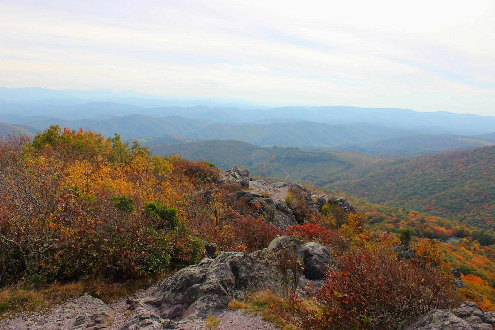 |
| view from Big Pinnacle |
I was overwhelmed by the day and kicked myself for overlooking such a stellar park. All the trails were easy and family friendly, the Pony interaction was definitely a highlight, and the views were second to none. I will visit this park for years to come and recommend you do the same. Hopefully my toes will stay intact and I can bust out some hikes now that leaf season is upon us, until next time...happy trails.
 |
| Cabin Creek Falls |


Subscribe to:
Posts (Atom)