Friday, September 16, 2016

Working in retail almost all holidays are consumed with long hours and stressed out shoppers for me, but there is one holiday each year that I vanish into the woods until I deem it safe to return. April Fool's Day is the national holiday of pranksters everywhere and being somewhat of a jokester myself, the only place I feel safe is in the middle of nowhere. The tradition began a few years back and now I plan for the day weeks in advance with this years destination settled in my mind maybe even before then.
The steps leading up to the Birch Knob Tower.
Views from the tower were fantastic with the changing skies. Looking back to Virginia, Tennessee, and North Carolina.
Onto the rock and off the tower, we were able to take in some new perspectives.
A shot from my rocky recliner  along the cliff edge.

Straddling the Virginia Kentucky border is the Pine Mountain Trail, a rugged beauty connecting Elkhorn City, Kentucky to Clintwood, Virginia. Along the way are many historical markers and spur trails leading to rock outcrops and waterfalls. Perhaps the crown jewel of the trail is the highest point of Pine Mountain and the Birch Knob Observation Tower. Most of the time I would scoff at human interference on boulders the quality of those topping the ridge, but I make an exception with the BKT. For one, it cuts down on graffiti by lifting would be vandals far enough off the rock face to do any damage, and two, it's design keeps it from interfering with your experience with nature. My planned trip would begin at the Birch Knob Tower and take me toward Kentucky as far as my legs would carry me that day. The weather looked perfect and a solo day in the hills had me watching the seconds tick off the last few hours of March.
Amy enjoying the view on Pine Mountain.
Loving my seat.
The skies were threatening rain but we stayed dry.
Does anyone else see a giant bird in the shape of this rock?

I mentioned a solo day for a reason. Sometimes my best made plans don't always work out, and rarely, I even feel moments of compassion. My friend Amy was struggling and it was obvious. She had suffered a death in the family and the world had her down and out. I reached out with an invitation to join me and her response made me already feel better about her mood, "This better not be an elaborate April Fool's Day prank."
It was a long way down from my seat on the rock outcrop.
Amy found ways to get even higher.
Some moss along the cliffs.

I don't think she really believed me until I rolled into the Food City parking lot to pick her up that morning and we hit the road for our two hour trip into the coal fields of Virginia. The excitement of the hike kept us buzzing with conversation and I felt a sense of relief seeing the gates unlocked as we wound up the gravel road to the tower spur trail. Arriving at the trail head we found we had it to ourselves and we launched into gathering gear and stretching out our legs on the short spur up to the steps that lead to the summit of Pine Mountain. Amy and I took our time climbing and stopped at each level for photographs before continuing to wind up the walkways and stairs to the observation platform. Several benches surround the main deck and I shed my pack and took in the 360 degree views. I had read that on a clear day you can see six states, North Carolina, West Virginia, Ohio, Kentucky, Virginia, and Tennessee. The views that day were far reaching with blue skies with white puffy clouds that would shade everything beneath them, ensuring no two pictures would be the same. After some time on the tower, both Amy and I felt our inner adventurer coming out and started looking for a way off the tower and onto the rock itself.
A straight line of weather kept us on guard.
The beginning of the PMT.
Amy looking back up to the rocks we just came from.
Erosion from water that once capped the mountain.

We settled on a spot on the walkway with a tree growing within arms reach to help balance ourselves for the hop over onto the rock. It wasn't pretty and even funny, but both of us successfully made it and were quick to spread out for more exploration. Amy worked her way back underneath the tower and toward the far reaches of the rock while I settled into a pothole on the edge of the cliff that worked like a natural recliner as i watched the changing skies pass by. I joined Amy after resting a few minutes and found the far side of the rock outcrops had some sheer cliff walls and some of the thickest undisturbed moss I'd seen anywhere. We played there for a while walking the cliffs like a tight rope before moving back to the main tower and the steps that led us back to the truck.
The Birch Knob Shelter is a nice one.
Amy is ready to move in.
Pole dancing with a pack on. I'm impressed.
Near the Jenny Falls trail head.

A nice kiosk with a detailed map is at the Pine Mountain Trail detailing points of interest and mileage estimates to each. My eyes were drawn to a spot some four miles away named Natural Bridge Ledge. Amy and I decided that would be our goal for the day with a stop at the 100ft high Jenny Falls for good measure. The PMT starts off on an easy downhill grade crossing a small creek for filtering water before lifting up the next ridge to the new and super cozy looking shelter. Amy and I took turns checking it out and decided a return trip for an overnight stay was in our future (see I didn't forget, Amy) and I couldn't resist climbing the ladder to peek in the loft. Thinking about it now, makes me wish I were there. Back on the trail, I was hoping that we would find wildflowers in bloom but spring was taking it's time creeping up the mountain and the lack of foliage made for some good views and exposed rock formations popping up on the ridge lines. The Jenny Falls Spur Trail is marked with a wooden sign about how the falls got its name and Amy and I began the long three tenths of a mile downhill hike into the mini gorge that is home to the falls. The downhill hiking is steep and I always dread coming back out but I knew Amy would want to see the waterfall and the large rock shelter across the valley from it, and after all, I was doing this for her. My kindness was rewarded about halfway down the trail when I found a large dagger stuck in a tree. We both looked at it curiously before I decided that if I pulled it from the tree it may mean that I'm some sort of royalty. Nothing happened when I did, so I'm assuming I'm just a royal a$$hole. The closer you get to the waterfall the more the plant life changes and mountain laurel closed the trail in from our open forest hiking. Soon I could hear the falls across the gorge and we stopped by the opening of the massive rock shelter. Amy was impressed and worked her way back to the furthered the corner and I made her my scale model to show the size of the impressive formation. Arriving at the waterfall, the nice white clouds vanished from the sky, and Amy got to sit in the shade and enjoy her homemade cheesecake muffins while I stood on a rock waiting for a cloud to photograph the waterfall. My patience was rewarded with a cloud just large enough to snap a few pictures and we started the climb back up to the main trail.
"Hey look, a dagger!"
By the power of Grayskull!
Amy at the entrance of the rock shelter.
Amy is smiling here too, you just can't see it.
Jenny Falls and the massive rock cliffs surrounding it.
It took a while to get a cloud at the base of the falls.

Climbing out of Jenny Falls was easier than I anticipated and we really made great timing on the level grade of the PMT as we passed through old home sites and historical markers, even stopping to let Amy try out an old bed that had reduced to nothing but a frame. Some impressive rock retaining walls were the only other clues of the once thriving community. The level grade was short lived and we began some steep down and up climbing from ridge to ridge or as Amy proudly called it, "Appalachian flat." I kept my eyes on the ground and the thought of the natural bridge kept me moving over each tough climb. On the way into one of the gaps Amy spotted a small garter snake I had nearly stepped on and we stopped for a minimum photo session while he patiently obliged. It was the first snake sighting of the year and it rejuvenated me as I hit a stretch of switchbacks that lifted us up to put first open view in quite a while looking far into Kentucky. Amy and I both agreed that it was the perfect spot for lunch and we sat along the cliff in the trail enjoying cheese, boiled eggs, and even those homemade cheesecake muffins she likes to spoil me with. You never would have guessed we spent hours as children thinking of ways to kill each other the way we get along now and the fact we can thrive as a hiking team is downright miraculous.
Finally, the clouds came and I was able to get my picture.
Rock retaining wall from an old home site.
Amy found a bed to kick back and relax for a while.
More rock walls surrounding another property along the way.

After our lunch we spent the next good bit of hiking wondering exactly how far we were from the natural bridge. We found ourselves parallel to a nice cliff line and the trail followed a safe distance from the edge until it started working it's way closer arriving at a large rounded rock that protruded from the main cliff. Initials carved in the sandstone dated back into the early 70's and Amy and I carefully climbed out for a better view. The drop off the rock was staggering. I would say it was at least a few hundred feet and it didn't take me long to make my way back over to the main trail. Amy got a good laugh out of my nervousness and leaned far over the edge taking pictures with her pocket camera. The trail stayed with the cliff for the most part before turning away but not before giving us a glimpse at another rock wall about half a mile further away. I predicted it would have our bridge on it.
The garter snake stole the show.
Heading out the cliffs with Kentucky on our mind.
What's this?
It makes me dizzy looking at this picture.
Gopro shot from the cliffs. You can see the large round rock back down the trail along the edge.

The trail lost some elevation but quickly started making a turn back toward the new set of cliffs we had seen making me feel even better about my prediction. We both hiked with a purpose and as we got close to the cliffs we found a small rock band separated from the main formation with enough room to crawl under if you were to lay almost flat. Was this our ledge? The precious bridge that we were promised? To be fair to the naming authority the rock was technically a bridge and right behind it was a ledge but hardly what we had anticipated. Amy's cynical humor came out as she mocked my bridge but after a fee minutes of disappointment myself I found it to be impressive from the right perspective. The bridge portion was speckled with white quartz and someone had made a small fire ring for what I'm sure is an interesting nights sleep at the edge of the cliff, and she won't admit it now, but I even saw Amy smiling.
More cliffs on the Pine Mountain Trail.
The Natural Bridge Ledge was a little smaller than we were hoping for but....
A little effort and we were under the bridge and at a small campsite on the edge of the cliff. We will be back and look, Amy is smiling!

Conquering the bridge we were satisfied with our day. The hike back was relatively uneventful and we shared stories and plans for future adventures. The trail had cured Amy and having a hiking partner was exactly what I needed that day as well. Our stomachs decided that we needed some real food by the time we reached civilization and I stopped at Robo's Drive-In near Pound, Virginia. The long wait made our burgers taste even better and we sat in the dark along highway 23 capping a perfect day.
Colorful rocks on the hike back.
It's hard not to be happy on hikes like this.

A few weeks later I stopped by my brothers house to visit my nieces. My eldest niece Abby is a student at Hiltons Elementary and Amy is her teacher. When the subject came up of my recent hikes, and the day spent on the Pine Mountain Trail with Amy, Abby spoke up and said, "We like when you take Ms. Hall hiking." I didn't need to but I asked why anyway. Abby responded with a giggle, "because she is in a lot better mood." Until next time, happy trails.


Monday, September 12, 2016

In an attempt to beat the heat this summer, several of my recent hiking trips have been geared for an eventual dip in the water once reaching the destination. In the last few years alone it seems that the popularity of hiking has exploded. Personally, I blame the internet and more specifically social media. This summer I've seen it with my own eyes, from the Snapchatters to the Instagrammers, they're out in full force.
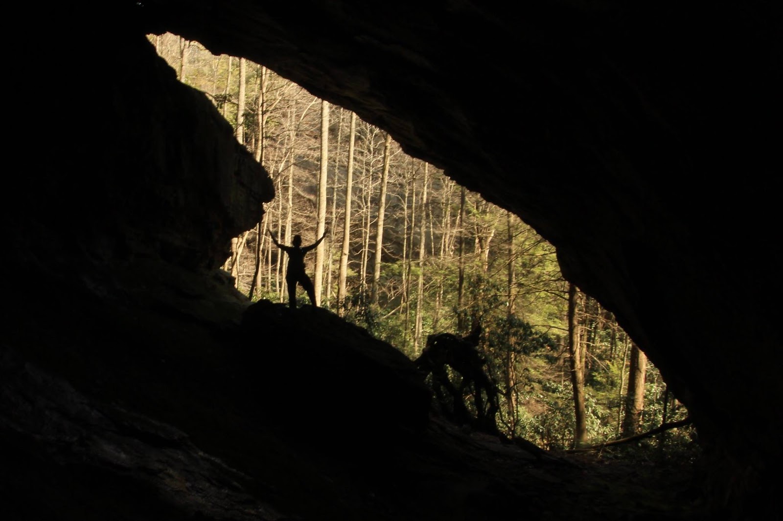
A warning or invitation, all a matter of interpretation.

With the added company on the trails have come an increased body count as well, including a several weekend streak of news of rescue crews fishing a carcass out of a pool for someone that either got to close to the edge of the falls or underestimated the power of currents. Tragic nonetheless but very preventable, and again I feel social media is to blame. The accepted norms and maintained trails have fell into the category of not enough risk or everyone has been there already.
If I remember correctly, there are around 80 steps that lead to the observation deck for Whitewater Falls.

My trail behavior has somewhat evolved in recent years and now that once in a lifetime shot doesn't have as much meaning after seeing the last in the lifetime attempts at those shots. I like living and adventuring as much as the next person but I like to come home that evening even more. With all this being said, I suspect you will think I'll launch into a "but let me tell you about this one time" story..well, yes and no.
Somewhere below the tree line would be our destination. The 411ft high Whitewater Falls is a sight to behold!

Not only have I tried to beat the heat but also maintain the best of the outdoors experience as I can with the least amount of company. The challenge of these type of hikes has been taxing to say the least but occasionally I get lucky.
Chicken of the Woods. This was so orange we spotted it from a few switchbacks away.

Difficulty alone will exclude the masses and nestled on the North Carolina and South Carolina border is a 14 mile river named the Whitewater. I can't think of a more appropriately named body of water since it barrels through slot canyons and over waterfalls on its way to meet Lake Jocassee in South Carolina. By far, the most popular destination on the river is Upper Whitewater Falls, a 411ft behemoth that is typically viewed from a observation deck on the side of the gorge.  The view from there is a good one and many people shell out the parking fee for a glimpse of the highly photogenic falls, including me, on several occasions, with each time a wandering eye to the point the waterfall is obscured by trees near it's base. An unwavering desire to make the hike to the base has lingered and a few weeks ago, I scratched it from the list....this is that story.
I think she was excited. Beyond the observation deck narrow stairs continue to lower you into the gorge.
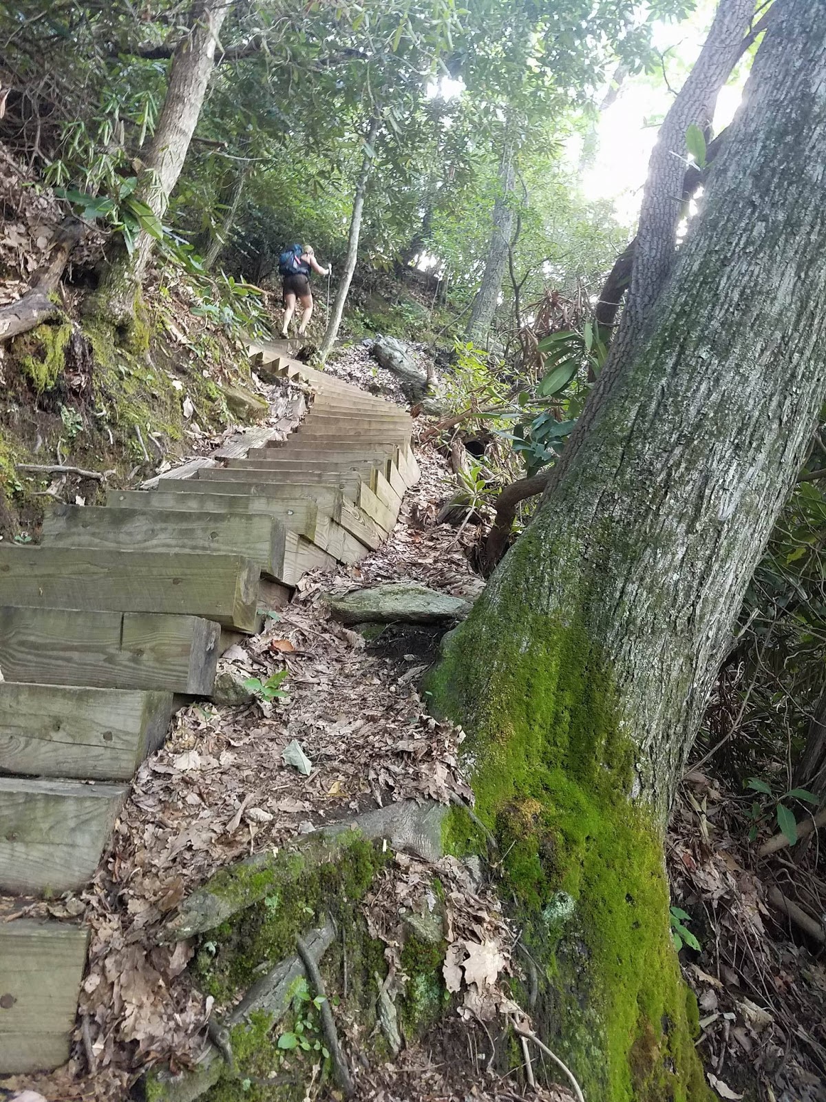
I'm not kidding around when I say these steps were narrow.

On a 95 degree day and a late start by my normal departure standards I loaded up and met my friend Jessica for the trip down to North Carolina and the Whitewater base expedition. I first met Jessica back in March on a chilly day on Little Stony and since then she has proved her obsession with the outdoors may outweigh my own. Group hikes for JDRF and adventures in the Northeast Tennessee mountains led me to believe she was ready for some true adventure in the North Carolina Mountains. The drive down is a long one at over two hours but conversations about hiking can pass any amount of time or distance. A short stop at the gas station on 281 for some snacks and a bathroom break it was only a few minutes before we were arriving at the packed trail head for Whitewater Falls.
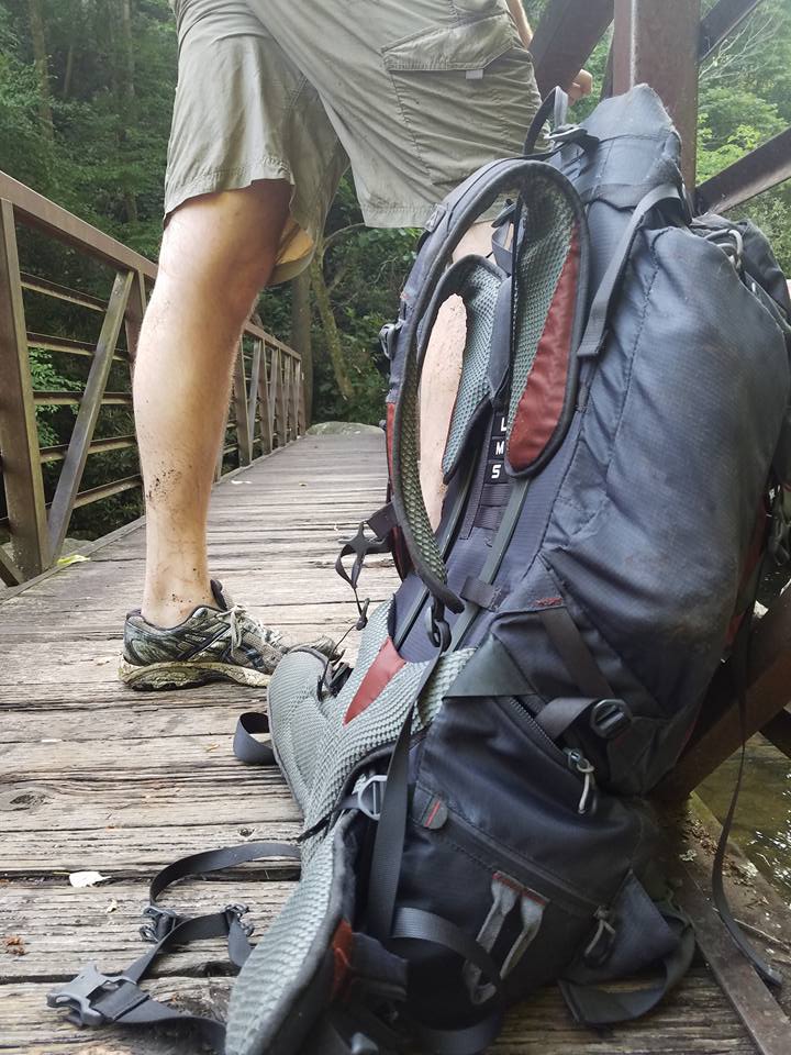
A metal bridge spanning the whitewater river is an excellent place to rest before taking on the off trail portion of the hike. This was actually taken after we hiked back from the base but for story telling purposes, it works here.

Knowing that we would succeed I had stuck a float in my pack taking the majority of the room and after some readjusting we were able to sneak the pump for it into Jessica's pack. The Instagram crowd was there in full force with flip flops on and cell phones at their ready, included in the mix was a gang of around 20 motorcycle riders that were intent on a group photo on the observation deck. Jessica and I received some strange looks as we both worked with our full packs and fetched our hiking sticks from the truck, but we didn't care, we were there for adventure. We only made it a few feet from the truck when the first crack of thunder startled the crowds but we continued on determined to see the base.
Beautifully carved rock on the river. The rain began to fall making for some fun scrambling.
Small waterfall below the main attraction.
And another nice waterfall. I really wish you could tell how large these boulders were!

At the edge of the gorge there stands a warning sign, and again at the observation deck stating that there are no waterfall views beyond the deck. Jessica was excited to see the falls for the first time and crowded her way over to the railing in silent awe, finally I had to nudge her, "you ready to go to the base?" The sign alone perhaps deters a few people but Jessica and I would encounter several other hikers on our way below the deck via the Foothills Trail where it crosses the river downstream from the falls. Along the way we stopped to photograph mushrooms, narrow staircases, and blooming mountain laurel. Thunder continued to threaten us increasing in intensity until a light rain began to fall as we were within earshot of the river.
Jessica along a nice slab of rock next to the river.
More rocks along the river. There was a tricky passage near this spot. Thankful for long legs here for sure.
Hiking sticks do no good on the Whitewater River.

We arrived at the river as a steady rain quickly soaked the rocks and made my rock hopping plan a river wading option. It was obvious that many people had made the trek upstream by the scramble paths that lined both sides of the river but Jessica and I started upstream by wading around a wide variety of shaped and sized boulders. In only a few feet in saw another pair of hikers marching upstream on the bank. We continued to stay in the water until we were cut off by a rock wall and a waterfall around 15ft or so. I made my way over to a small island the river and thankfully noticed a Yellow Jackets nest before suffering the consequences. Seeking shelter from the rain, the other hikers were having snacks under a cliff and I stopped to talk to them for a minute. They both were friendly and said they planned on getting to the base as well. Jessica and I lost sight of them after some technical rock scrambling and one narrow ledge we used to escape another waterfall we would struggle to get around. I was impressed with Jessica's determination and she led us upstream on a pace that was hard for me to match. I knew she was excited to get there but she didn't have to run!
But there are some serious rewards on the horizon.
Getting close now. The mighty Whitewater Falls is surreal from the base.
This picture is pretty neat. There is one of the largest waterfalls I've ever seen in my life right in front of me but she stops to take a picture of a wildflower.

The first glimpse of the base of Whitewater Falls came as I popped onto the top of a boulder where Jessica exclaimed, "would you look at that!" The entirity of the 411ft falls could not be seen but the bulk of it was in view and we were still about 100 yards downstream. Both of us stood in a trance before reaching for our cameras for a few shots until we were in a race to reach the swimming hole on the far right side of the falls. I honestly don't remember which of us reached the pool first but I know that I was quick to unpack my float and demand Jessica fetch my pump. I went to work pumping up the float while she unpacked our snacks. Our privacy was short lived when the young couple from South Carolina finally caught up just as I was finishing with the float. They were quite a bit younger than us but were very friendly and the four of us shared the joy of being at the base of such a huge waterfall. They had traveled about the same distance as us to be there and I waited for them to take their pictures before I decided it was time to launch my float. One problem though, my float was now missing.
A wonderful swimming hole. Time to get busy!
There goes my float!
Finally afloat!

Paddling across the deep pool was Jessica atop the missing float and she explored every corner of the area knowing I was waiting for my turn. She finally returned with a sneaky grin saying, "oh, were you wanting this?" When I finally got in the pool the water was cool but refreshing and I paddled across to the brink of the falls. Sometimes we let specific moments fade from our memories but riding a float at the base of Whitewater Falls will last with me for a long time. I lost track of time and the rain had faded as the sun popped out making our swimming hole even more inviting. I rejoined Jessica long enough to enjoy some summer sausage and cheese and saying goodbye to the South Carolina kids as they packed up and headed out. Jessica went into full explorer mode and crossed the river climbing high on a boulder above a long cascade while I continued to play on the float before crossing over myself to see the falls from even more angles. Jessica seemed tiny up on the rock face and I settled for working my way downstream to include as much of the waterfall as I could in the picture. It took some convincing but I finally got her to come back down so we could pack up for the hike out.
I was like a kid in a candy store. Floating here was definitely worth the effort to pack my float up that river bed.
Whitewater Falls Base Selfie.
I was feeling the pinch while trying to enjoy my float.
Downstream from the base.

Being there was incredible but I knew that getting back out would be a challenge. Luckily the sun had gave us the ultimate assist in drying many of the rocks for our return trip and when we made excellent timing taking a slightly different route. At one of the trickier rocks I used Jessica as an anchor and I hoisted up on the rock belly first thanks to her help, I'm sure she won't let me live it down. We exited the river to hike along an impressive cliff before bushwhacking back out near the water's edge at the bridge across the river.
From my float trip across the pool.
Here's some perspective. Jessica on the side of the waterfall.
AND her view back to me by the swimming hole. Whitewater Falls is fantastic!
Napping on the river.

We both were tired and climbed up on the bridge for a short break before climbing out of the gorge. The climb up was easier than I had thought it would be and we arrived back at the observation deck with tired legs and soaked clothes with sweat. We took a few pictures before climbing the remaining steps to finally reached the paved downhill path to the parking area. Thankfully Jessica had thought to bring some wet wipes and we cleaned up on the tailgate as onlookers wondered where we had been to get so dirty. Just as we finished cleaning up enough to get in the truck another storm blew into the gorge with a torrential downpour sending everyone scrambling for shelter while we laughed it up from the safety of the truck.
Hiking back was no picnic.
Infinity pool on the Whitewater River.
UP and UP. Heading home just ahead of another storm.

It's hard to put a finish on such a nice hike, even now, weeks later. Whitewater Falls is such an impressive place but given a fresh perspective it seems otherworldly. On a daily basis I'm asked how tall I am, but to stand at the base of that waterfall, I'm merely an ant, and man, that's a great feeling. Until next time, happy trails.