Wednesday, January 30, 2013

The Rocky Fork encompasses 10,000 acres of mountain wilderness in Unicoi County, Tennessee. Recently it was announced this area would become Tennessee's newest state park. I found the news to be bittersweet, while the trails need some overhauling and better access points, the untamed aspect of hiking there is a welcome escape.
1st falls on Higgins Creek (100ft high)
Frontal view of 1st falls
2nd falls
hidden 3rd falls. 4th falls is almost completely hidden just upstream

Lower Higgins creek is part of the Rocky Fork track and features a two mile stretch where it is pinched through one of the most rugged gorges I've been in. The best part is that the severe elevation change here creates some wonderful waterfalls. I have hiked the area many times but never with my faithful hiking buddy Strickler. Yesterday, we traveled to the trail head at the end of Lower Higgins Creek Road and started the grueling uphill hike into the gorge. The trail begins at the most ricketiest bridge I've ever seen or crossed, I fully expect it to be gone each time I go here but it hangs on somehow. I used the Everytrail App on my phone to track our stats such as speed, elevation change, and distance. The trail follows the creek the entire way and the small cascades and deep pools help take your mind off your burning legs. Just before the first and largest falls, the trail takes a brutal increase in elevation and by the time it levels off above the 100ft high waterfall you barely have time to catch your breath until you have to start the steep scramble to it's base. There are no steps or hand rails but there are grapevines and tree roots to keep you from tumbling to the bottom. Maybe my many trips here have lessened my appreciation of what a great waterfall it truly is but Steve raved about how wonderful it was and said it was one of the better ones we had visited in our area. I took time to wade downstream and took some pictures of the smaller cascades below the falls,  it's hard to believe it's warm enough for creek wading in January but yesterday's high temp was 70 degrees! We climbed back to the trail head which is no easy feat and continued upstream to the next waterfall. It's a lot smaller but still a nice sliding 20ft cascade. Just upstream from this falls is the first creek crossing, there are two options here, continue on the trail to the small set of rocks to jump across or catwalk a tree limb that has been cut and placed over the creek just downstream. We chose the rock hopping, I waded and Steve managed to keep his feet dry. The trail continues on for a short distance before swinging back to the creek and another crossing, this one proved to be more difficult and I waded in and set up some make shift rock steps for Steve to make it dry again. For a brief stretch the trail levels, during this time Steve expressed his hatred for me and my crazy trails. I pointed out that we were in a stretch of five great waterfalls, he wasn't wearing a tie, and he had just got a raise...so shut up. Once again the trail climbs, just off to the left two separate 30ft falls can be seen down through the laurel. They both are pretty and picturesque but would require a bushwhack to get to. I told Steve we would save our energy and get to the 50 footer upstream. I like this waterfall the best, it can't be seen from the trail only heard. There is no sign of a established trail and the best way to get to it is just start wading through laurel. Anyone who has off trailed through laurel will note it's strength, flexibility, and unwillingness to break under any circumstance. I only knocked my hat off a few times and we met the creek about 20 yards downstream from the main falls. The falls Cascades in the upper part before free falling into a rock framed pool then further cascades down to the creek level.
nearing the base, the trail is steep

50 foot falls on Higgins Creek
We spent some time recovering from our bushwhacking efforts and took a different approach out which was equally fierce. I had never hiked upstream from the falls and we continued up the main trail and eventually we crossed the mountain and found ourselves in a flat area where the creek is really broad and shallow. We decided we would return in the summer and do some camping and continue on even further up the creek. I looked at my App and from the topo map about another mile upstream there are some significant elevation gains so there should be some more waterfalls. Sadly, we were running out of daylight and turned around, the trail is much easier going back because it's all downhill and before I knew it we were back to the final creek crossing. I started across at the rocks but Steve continued downstream to the tree branch. "This is where we crossed last time" "Yeah, I know but I can walk that tree branch." I told him to at least let me take some pictures of the attempt. He carefully stepped out on the branch and pushed on it with one foot to test the strength, and without further hesitation put both feet on the branch. To his credit, he did make two full steps before swinging his arms wildly, jutting his butt out, catching his balance briefly, leaning the other way with the same routine, before finally releasing a string of obscenities as he crashed to the water. I doubled over unable to take anymore pictures laughing hysterically. Steve continued his colorful language and we laughed the remainder of the way back to the truck.
down he goes

I would recommend visiting Higgins Creek before the state park system takes it over and appreciate it's rugged beauty. I'm unsure how they can make the trails any easier to visit the falls but an easier hike will be a welcome change from bushwhacking and creek wading. So pack some water, dry shoes and socks, and wander into the Rocky Fork wilderness and until next time...happy trails!

Monday, January 28, 2013

Last Year, Kip and I visited Jones Falls, a secluded but beautiful 100ft waterfall just off the Appalachian Trail. That day, we hiked in from the Tennessee side parking at a church on Campbell Hollow Road and trekking the three miles to the falls. It was a difficult trip with lots of up and down climbing and multiple creek and road crossings. I loved the waterfall but I considered it a one and done hike due to the difficulty.
The trail follows closely alongside the river
At the T intersection. see the white blaze, that's the AT.
Warning sign at the base of Jones Falls
Jones Falls

Recently I read about a different route that approaches the falls from the Elk River below Elk River Falls and uses a spur trail to reach the AT. The hike was also a mile and a half shorter so I decided when I had time I would try it out. Today I was off so I traveled to Elk Park, NC and reached the Elk River Falls parking area by noon. A forest road parallels the trail to the base of the falls and you follow the road around the falls and eventually it switches back and forth and arrives back at the river at a ford. Instead of crossing the river stay on the left side looking for a faint trail across a field. On the opposite side of the field the trail reenters the woods and crosses a extremely small stream. Within another few feet another stream enters the Elk River, this one is larger but can be crossed without getting your feet wet. This creek is Jones Branch, the trail rises after crossing the creek (you will be on right side of creek) and stays with the creek and comes to a T intersection. Turn left here, you will notice a white blaze on the tree just up the path indicating the Appalachian Trail. The AT is really nice in this area and it rises steeply winding through the valley with Jones Branch far below the trail. Within twenty minutes the creek begins to increase in volume as you near the falls. The AT swings away from the creek and you get out of earshot of the water and arrive on a ridge with views off the right and left sides. The trail eventually starts breaking back toward the left and through the trees you can see the upper portion of Jones Falls (this view can not be seen at the base of the falls or from the Tennessee entrance) It appears to be a near vertical free fall of at least 80ft. Look for a double white blaze indicating a severe change of direction and a small sign for Jones Falls off to the left. The trail winds around to the base of the falls. I was greeted with a nice surprise, the waterfall was covered in ice. It was amazing, and since my last visit a sign had been posted warning people not to climb on the rocks that several people had been injured there. I couldn't really tell where was rock and what was ice, I stepped several places that squeaked and cracked indicating a thin shell above the stream and had to backtrack. It was tough footing and slow going. I was able to kick out some foot holds and scale the lower portion of the falls for some closer views of the large icicles formed next to the upper free falling portion. The temperatures were in the fifties and some of the large ice chunks were melting loose from above the part of falls I was under and were crashing wildly all around. I decided this was too dangerous and retreated back to the main trail for a few more pictures before heading out.
Ice cascade
Even with the sign, I liked this picture
Upper Falls, ice everywhere
Upper Falls through the trees

On the hike back, although I had visited Elk River Falls many times I couldn't resist the five minute side trip to check them out again. There was slight ice build up on either side of the falls but  nothing like Jones, I traced my away around to the edge of the large pool to try to cut out the sun in my pictures but I didn't have much luck. I hadn't wasted much time and decided to ride on down to Linville and catch the Blue Ridge Parkway looking for an afternoon adventure, but I will save that trip for a later post. Until then...happy trails.
At the top of mighty Elk River Falls
Ice cold water at Elk River Falls

>

Wednesday, January 23, 2013

Upper Stoney Falls

While most people complained about the weather yesterday, I was busy bundling up and planning a hike. On what has been the coldest day of the year thus far, I couldn't let my off day slip through my fingers. Earlier in the year I had hiked with dad at the Hanging Rock area in Dungannon (VA)  and with recent heavy rains and the chance of ice accumulations I knew there would be no better choice than frigid Little Stoney Creek.
first bridge crossing
long sliding cascade
cascades along the way

The hike starts at the Hanging Rock Recreation Area which features picnic tables and shelters but during the off season is gated. It's only a short stroll up through the picnic area to the trail head for Little Stoney National Recreation Trail though. The main attraction along the trail is the falls of Little Stoney. Several nice cascades and two large waterfalls are located on the trail at about the 2.6 mile mark. The first part of the hike is fun as you make your way along a large exposed cliff creek side, monstrous boulders have to be negotiated up and around and there's even a section you can squeeze between two of them if you choose to do so. After about half a mile the trail crosses the creek on a large suspension bridge built high above the creek to avoid flooding. The recent snow was piled deep on the bridge and I found myself with wet feet just as my hike was starting. Shortly after the bridge the park service had posted signs indicating the trail was closed due to trees being down and a collapse in the trail along a steep section. I didn't want to waste all the gas and a perfectly good hike on a warning sign so I proceeded on up the creek. The snow was still at least a foot deep in places due to the sun not reaching the valley floor but it was pleasant and absolutely beautiful. I eventually found the section they were referring to in the sign. The trail wound narrowly about fifteen feet above the creek and two large trees had fell taking their roots as well as the trail with them. I had to slide down the bank and then use whatever I could  hold onto to get back up to the trail. Several more wooden bridges cross the creek just upstream and eventually you wind up on the right side of the creek. Cascades really begin to pick up in this area and several small waterfalls enter into the creek from side streams.
icicles everywhere
huge cliffs lining the trails
Stoney Creek from the trail
trail crossing a waterfall

My favorite part is just before Lower Stoney Falls the trail crosses a side stream in the middle of a waterfall! The upper part of the falls is hidden by trees while the lower section drops over two different fifteen foot sections. It's a tricky crossing and the result of missing a step would be at the least some wet clothes and the worst a broken bone or two. Finally after just over two miles Lower Stoney Falls comes into earshot. As the trail winds upwards the falls become visible. It is the better of the two falls cascading over a cliff before pooling below and dropping over a few smaller falls downstream. The spray from them had iced everything around and footing was tricky as I lined up photos. I loved the icicles hanging around the sides of the falls and it framed up nicely with what light was peeking through over the ridge. I managed not to fall in the creek and headed up trail to the Upper falls. This one free falls into a large deep pool and during the summer you will never have the falls to yourself, but on this 19 degree day I was alone. I took some pictures from the stairs framing the falls with the trees before heading down to the base. I found some nice opportunities using the cliff wall covered with icicles with the falls alongside it. The cold weather didn't bother me but was messing with the response time with my camera so I decided to pack up and head back toward Hanging Rock.
Foot deep snow on the rails
Upper Stoney Falls
Middle Stoney Falls
Lower Stoney Falls

It's funny how on some of the hikes out, I see things I completely missed on my way in, but that adds to the joy of hiking. I probably took another fifty pictures just on the way back. I made really good time, even in the areas with deep snow and found myself back to the truck within an hour. Sadly the Hanging Rock Rec Area is still slated to close due to budget shortfalls, so I encourage you to contact Congressman Morgan Griffin's office to voice your opinion and save this Scott County beauty. If you ever hike there, you will see why we should keep it around for future generations. Until next time, happy trails!

Tuesday, January 15, 2013

Until today I never knew the value that is a .88 cent Walmart rain poncho. It's a no frill piece of plastic but my upper torso and $1200 camera sure did appreciate it's rain repelling ability. Over the past 24 hours it's rained over two inches and with the ground being completely saturated from rain from the previous few days, flooding was inevitable.

Foot bridge over Laurel Creek
THAT would kill you.

Laurel Fork Gorge is home to a section of the Appalachian Trail and Laurel Falls. The falls is by far the most popular hiking destination in the Tri-Cities area and despite the lousy weather, I was somewhat surprised when Steve and I arrived at the trail head to find no one else. From the parking lot the creek was already drowning out any chance of conversation. The rain increased as we made our way through Pond Mountain Wilderness, and we broke the ponchos out, trying to stay at least partially dry. As the trail wound between the ridges, the creek roared the canyon to life. The spray from the creek shook the leaves as if the wind was blowing. We had to cross the creek on a footbridge and the water was ripping through and with an open side (no rail) it made me dizzy as the water rushed underneath us. After ascending a ridge, I could hear Laurel Falls down in the canyon below. The trail takes a sharp turn down some rock stairs to the base of the falls. We only made it half way to the base before we entered the spray zone from the flooding. My .88 cent poncho made a valiant effort but was ripped in half by the wind flapping it wildly. I used what was left to wrap my camera and proceed to the base.
Laurel Falls today
Normal flow of Laurel Falls (took this one a few years ago)
just incredible!

I couldn't believe my eyes, Laurel Falls was almost indistinguishable with thousands of gallons roaring across the drop of the falls. The water was hitting with such force it was splashing back up half way on the main falls. The mist was like standing in a shower on the left side and I retreated downstream to a rock around a bend in the creek so I could actually get a few pictures. My normal spot I photo from was under four feet of raging water. It was impressive to see the power of water and sit creekside in the mist although I was so far away from the falls. I was thoroughly soaked but didn't regret my decision in hiking in the bad weather. Even Steve's mood had improved and agreed we made the right choice but said now that he had seen it with such power he would be disapointed visiting any other time. The hike out was straight up the stairs but my stamina has vastly improved and didn't have to rest at all on the hike up and out. The rain was unrelenting on the hike out and looked down at a certain point and noticed my feet were covered in foam. A while back I had soaked my shoes in spray and wash and never ran them through the machine and now my foam soaked spray and wash feet were litering the trail on the hike out. Steve had stopped to tie his shoes and when he caught up with me he said it looked like a wild animal had been drooling on the trail. We shared a hearty laugh but abandoned our next hike to Coon Den Falls, we threw in the towel...and the .88 cent poncho.

Sunday, January 13, 2013

January weather typically doesn't give you gifts like today. The forecast was for 70 and sunny and I wasn't going to waste it looking out the window. I usually visit waterfalls on cloudy days because my pictures turn out better but when the weather took a turn for the better I ditched my orginal plan of hiking into the Linville Gorge and exploring the area downstream from the falls. I had read that it was some of the most rugged terrain in the east and it peaked my interest. During my research of the Linville area I happend across two nearby peaks that looked fantastic.
Approaching the edge of the gorge
Table Rock and the Linville River

Table Rock Mountain is easily seen from the Balds of Roan Mountain and I've always wondered if it could be summited based on it's unique shape. Hawksbill Mountain neighbors Table Rock and has wonderful views of Table Rock, Linville Gorge, The Chimneys, and Grandfather Mountain. I planned on hiking to the summit of Hawksbill first and then traveling the two miles to the summit trail for Table Rock. I hit the road early Saturday traveling through Roan Mountain across the North Carolina line into the towns of Elk Park and Newland. I followed 181 toward Morganton and found the turn for Gingercake Road and headed up the mountain. The road steadily winds upward and goes through the super rich neighborhood Gingercake subdivision literally built into the cliffs. At the end of  the subdivision the road turns to dirt and enters the national forest. North Carolina must have a budget shortfall because there were no gravel at all and the wet weather the few days before had the road in horrible shape! I was terrified as the truck slipped and slided along the cliff side road but was determined not to turn back. I made it to the parking lot after three terrifying miles and found two older gentelmen unloading camping gear from their van. I asked if I was in the right place and told them my plan, One of the two said "I hate to break the news to you but Table Rock is gated this time of year because the road gets in rough shape." I said, " The road I just came in was NOT in rough shape?" They laughed and welcomed me to North Carolina in the winter. I grabbed my camera  and crossed the road and found the sign indicating the Hawksbill Trail. One of the guys yelled as I started up, "You better take water because it's straight up." I held up my Gatorade bottle and said "Thanks, you guys are full of good news." The trail climbed steadily and switched back several times in the first half mile. About half way the trail becomes really rocky and turns up the mountain at an ever steeper incline. The final two tenths of a mile gain just under 500ft of elevation before summiting! It really winded me, I had to sit down at the top before settling in taking photos. My resting spot was one of the finest camping locations in all the mountains. To my left Table Rock and the Linville Gorge were in full view and to my right was the rocky summit of Hawksbill Mountain.
nearing Hawksbill Summit
Grandfather Mountain (center right)
looking down th gorge and the Roan highlands in the distance

I started down the trail toward Table Rock scrambling across boulders and small shrubs. I eventually found a drop off the side of the gorge with a large flat rock to scoot out on into the heavens for pictures of Table Rock and the Linville River roaring below. I waited here for a while because of the clouds but the sun eventually peeked out and I got the shots I wanted. From there I climbed to the summit of Hawksbill, the mountain comes to a jagged abrupt end, with large flat rocks protruding in different directions, it literally is the definition of ruggedness. I was more fond of this area than the lower end of the trail, and along the cliffs edge Grandfather Mountain could be seen in the distance as well as more fantastic views of the Linville Gorge.
Long way down beyond the rocks
underneath one of the rocks of Hawksbill.

I honestly don't know how this area has remained a secret to me for so long, it is one of the finest spots from mountain views...anywhere. I can't wait until later this year when the forest road to Table Rock reopens and I will have access to the summit there and the Chimneys trail along the gorge. Until then enjoy the pictures, and happy trails.
looking back toward Table Rock
Final view from Hawksbill


Friday, January 4, 2013

If I could find a job that would pay me what I make now and sell my house, I would move to North Carolina tomorrow. My wife doesn't quite share my enthusiasm but I'm sure she would get on board once my bags were packed. Many people don't know this, but Transylvania County is known as the land of waterfalls. There is nowhere in the WORLD, there are more waterfalls! Over 200 waterfalls are in Transylvania County alone, and one day I will knock them all out. Until then I will do my usual dance of reading, drawing out my route and picking off waterfalls at a rate of 10 per day trip.
Cathey's Creek Falls

I had a good plan laid out and the weather looked fantastic, the cloud cover was perfect and my camera had been charged the night before. My first stop was the Cathey's Creek area just below Brevard, NC. I had traveled by here numerous time unaware there was a waterfall until recently reading a book describing an 80 foot waterfall on Cathey's Creek. The road is paved for a short distance but turns to dirt after entering the national forest from there the road follows the creek but eventually swings away from it and switch backs up the mountain at a steep pace. On the right far below road level Cathey's Creek Falls is visible. My first thoughts were that it had to be higher than 80 feet! A trail follows the bank down to creek level but it's got some fallen trees around suggesting not many people are aware of this beauty either. A large dead hemlock rests near the base and is a good prop for photography since I didn't bring a tripod. Some good photo ops looked just out of reach on the opposite side of the creek but I had a long day and wasn't going to start it with wet feet in 40 degree weather.
Easatoe Falls (private property)
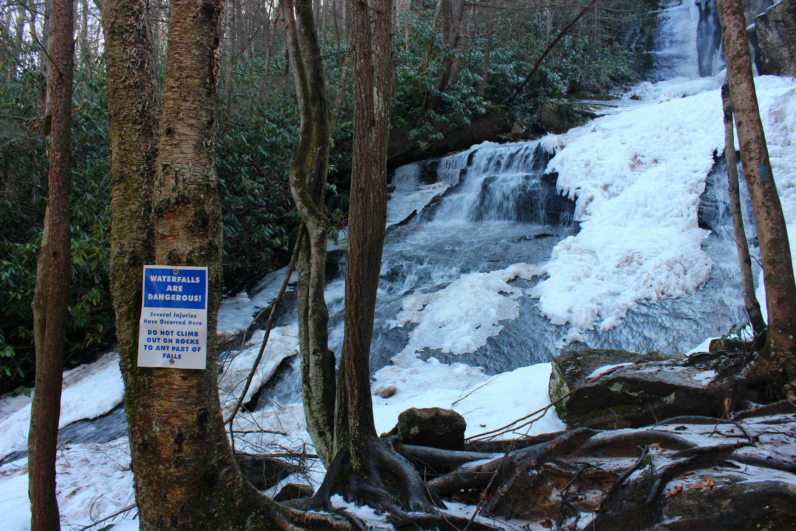
people kept getting lost looking for the waterfall

From Cathey's Creek I headed west on 64 and eventually turned on 178 near Rosman and followed 178 toward the South Carolina border. Easatoe Falls is just off of 178 on the North Carolina side, unfortunately it is on private property behind the owners house! I had read countless blog entries looking to see if access was still allowed from the owner but found nothing. I decided to stop since all he could do was ask me to leave. As I pulled up to the house I could see the falls behind it and my nervousness faded. After I got out of my truck I could hear a chainsaw running and found an older gentleman cutting a fallen tree near the falls. I introduced myself and asked if he minded for me to take some photos. He was really nice, and I thanked him for his generosity allowing people to still visit such a wonderful waterfall. He told me that they enjoy the visitors and everyone had been respectful, and I tell you now, there is no finer waterfall in North Carolina. I loved it, I have to say it's my favorite (subject to change) and it's beauty translates well onto film too. The falls is at least 85 feet high and free falls and cascades in a unique setting. Although it's directly behind someones house, the area around the falls is relatively undisturbed giving you the feeling of being on a remote hike deep in the mountains. I spent over thirty minutes climbing around soaking this beauty in.
Twin Falls

My spirits were high after visiting Easatoe Falls and I was in a great mood as I wound on down the extremely curvy 178 to the South Carolina border. The continental divide is just before the border and the mountains really begin to drop off at a rapid rate. With all the loss in elevation I knew I was in for a treat at Twin Falls. All the guidebooks described it as being spectacular or excellent. I guess in my excitement I had misread the directions and blew by the turn for the falls. Instead I found myself lost in the South Carolina mountains with no cell service. Eventually I came to an intersection and a run down gas station. I went in for a drink and came out with a waterfall guidebook of South Carolina, I knew there was a reason I got lost! I made my way back to the turn for Twin Falls and quickly arrived at the nature preserve parking area. I don't think I've been on an easier trail, well besides that guys backyard from earlier. The trail is flat and is less than a quarter mile before arriving at a wooden ramp that ascends into a observation shelter complete with benches. This is an outstanding waterfall! Twin Falls literally has it all, free falls, cascades, shoals, all rolled into one. To the left a drop of 80ft free falls and then cascades another 30 feet down the gorge. The right side of the falls cascades wildly over multiple drops stretching an even greater distance of about 120ft before rejoining the main part of the creek and emptying into a clear swimming hole. I couldn't just stand on the deck, I had to get down and explore, I jumped the rail and scrambled down the bank to climb up the creek toward the main falls. It's rare that I feel so small but I was dwarfed on all sides by this massive waterfall. I thought of my dad and how much he would enjoy being here even though he would probably be content on the benches in the shelter, it would still be nice to have him with me. I took my pictures and headed out 178 rejoining highway 64 at Rosman. I still had plenty of time so I took the twenty minute drive down to Cashiers and highway 281.
Whitewater Falls
I took this picture UNDER the observation deck.

Highway 281 has an extremely high concentration of waterfalls, and these are no puddle jumpers either, they are massive and even deadly. Along this stretch of road is Gorges State Park with Rainbow (136ft) Turtleback (30ft) Drift (80ft) Stairway (100ft) and Windy Falls (over 700ft!) Windy is accessible only if you are insane, wish, to die and no one ever be able to recover your body, but Kip and I will hike there later this year. Also along this stretch of road is the less visited Thompson River area, there are no signs only books written by locals to find your way here. The Thompson River area houses High Falls (125ft) three other waterfalls that are unnamed at 70ft or greater and the mighty Big Falls (200ft) I almost became part of the North Carolina food chain last time I hiked there. Most people visiting waterfalls here are lured to Whitewater Falls, the reportedly highest waterfall east of the Mississippi at 411ft high. (Buckeye and Windy Falls both are near 700ft) Whitewater gets it's fame because of the ease of access and the massive amount of water the Whitewater river dumps over the falls. It's hard not to be in awe of such a sight. Just as I was getting to Whitewater falls a fog bank rolled over the mountain and made it impossible to see the falls in it's entirety. I was slightly bummed but visited with a family from Indiana and took some photos of them on the observation deck at the cliff edge. I waited around hoping the fog would lift but it would clear only long enough for a view of the top or the bottom but never the entire falls. I had read about some smaller falls along 281 that were off trail and decided to try my luck at them.
White Owl Falls
John's Jump Falls

White Owl Falls is only 20ft high but proof that a waterfall doesn't have to be huge to be beautiful. The water drops over a large boulder shelf and is framed by mountain laurel. There isn't a trail but a scramble down the road bank and the sound of water led me there. The same can be said for John's Jump Falls, again I scrambled down the road bank to the top of the falls. I was excited to see another waterfall and leaned on a tree that was rotten and it dropped me over a ledge turning my ankle and smashing my head on the ground. I wasn't hurt but I was definitely dirty. I wiped off and made it to the base. It was worth my efforts it is a really nice 30ft waterfall with the same cascade effect as White Owl. I really liked it and thought about how many people pass it up as I could hear the cars whizzing by up the bank.
Looking Glass Falls

When I got back to the truck my ankle was hurting so I decided to head home. As I went through Brevard though I couldn't resist riding up to Looking Glass Falls for a few photos before calling it a day. Today my ankle is purple and swollen but it will get better and eventually I will get back to North Carolina. Until then...happy trails.