Thursday, December 31, 2015

Just a few hours remain in the year 2015 and I can't think of a better way than wrapping it up than to tell a hiking story. Tonight's entry actually was a year in the making and the culmination of a goal I set on this day in 2014. In that year, I hiked 386 miles and decided that I surely could manage 400 miles in 2015 but after wrestling with it in my mind, I rounded it up to 500. I made a Facebook page to mark my progress and headed out for a night of darts and drinks with friends to ring in the new year.
Charlie's Bunion. New Year's Day 2015.
Shows up an hour early. Shovels out two parking places for hiking in knee deep snow.

The following morning I was up early and on the road to the Smokies for a hike to Charlie's Bunion with a group of friends, and after one day I had eight miles. I hiked again on January 4th and netted four miles, and again on the 7th, and slowly the miles started to pile up. At the end of January I had already hiked 70 miles and felt like my goal was well in hand but February had other plans. The weather took a turn for the worse and I worked the majority of the month limiting my production. A slip at Buckeye Falls resulted in a torn ligament in my ankle and suddenly I was behind of the pace needed to meet my goal. With the arrival of March came better weather and a healing ankle helping me get back on pace and exceed the 44 miles needed to stay on pace for the month. The April showers did little to dampen my spirits and more miles piled up and I spotted my first ever bobcat in the wild and fished a drowning friend out of the Devil's Bathtub.  In May, I marveled at the wildflowers and the little things along the way and I started seeing a change from my frantic pace to truly savoring the experience, but another mishap caused me to break my toe while solo hiking at Monkeyhead Rocks in Erwin. The diagnosis was to take four weeks off to allow it to heal, as I write the blog tonight, It's more crooked than ever and still sore.

Josiah Falls with Amy and (not pictured) Mike Castle.

Behind an off trail waterfall in Jefferson National Forest with Shane and Halley.

Hanging with the girl scouts behind Little Stony Falls.

and Fund Raising for JDRF on the Sand Cave hike.
Warmer weather and the month of June had me craving the water and I gave up several hiking opportunities to float the river instead. However, I did pass the halfway point of my goal at mile 250 with Amber in the Grayson Highlands and a play date with the wild ponies. Bouncing from town to town on work assignment I spent many evenings hiking alone but as the calendar flipped to July, I reunited with one of my former coworkers on a memorable race against dark hike in the hills of Appalachia and then at the end of the month I even got Mike Castle out on the trail for a hike with Halley and I to Devil's Creek and a refreshing swim at dusk to celebrate mile 300.
All smiles at Devil's Creek.
Amber decided it was this pony's birthday.
Refreshing and recharging. Mile 300 at Devil's Creek Falls.

Feeling confident in my efforts and mileage, I eased into August with a more relaxed pace......just kidding. Having reconnected with my childhood nemesis Amy Hall, I discovered her love for long hikes and marched her through the Roan Highlands and a fifteen mile day in the sweltering heat of dog days. To celebrate my anniversary I revisited Chimney Tops with Amber and Jeff Forrester since he was the one who led us to that awful climb over four years ago.  As August faded and September arrived I entered the month knowing mile 400 was well within my grasp and my overconfidence about put me in the ground. In the Linville Gorge while hiking alone, I ran out of water, fainted, and later encountered bears at dusk. It made for a great story but also served as a harsh lesson and it was my last long mileage solo hike of the year.
South Carolina waterfall huntin'
So that's how the Roan Highlands keep their balds.

Shane peeled away from work and Chattanooga long enough to take one of the best hikes of the year from Low Gap to Damascus and the craft beer at the end of the day never tasted better. Back in Virginia, I spent an evening hiking with Henry, Becky, and Jon to the Killing Rock near Pound, Virginia and nearly laughed myself to death when Henry realized he parked in human feces. Near the end of the month I marked the 400 mile mark with my Godchild on a trip to Laurel Falls near Hampton, Tennessee.
Poor Josh. Hiked straight up a mountain in work clothes and boots that weigh more than me.
Baize and I were excited to see mile 400 fall in the Laurel Fork Gorge.

October is by far my favorite month to hike and I did plenty of it with a vacation purposely scheduled to coincide with peak leaf season. A visit to the Talus Fields with Halley, a hike to Buzzard Rock with Amy, and a special father and son day in the Unaka Mountains helped me reel in the dream of mile 500. As the leaves faded and the calendar turned to my least favorite month of the year I was only a few miles shy of my goal. I couldn't think of a better person to let choose the finale than Shane Estep. Shane had hiked with me as much as anyone throughout the year and when he suggested the Pinnacle in Abingdon I happily agreed.
Dad climbing to Pinnacle Tower.
The mighty Talus Fields and my favorite four legged hiker, Sallie Gator.

The Pinnacle is a really short hike at a little over a mile round trip, so I took a few short hikes to get to mile 499 and the celebration hike with some of my friends. On a crisp Sunday morning, I met with eight of my friends in Abingdon for the short ride over to the trail head to the Pinnacle. It was a perfect collection of hikers with Amber, Shane, Halley, Kinlee, Amy, Steve, and John braving the chill to spend a day playing among the unique boulders in the shadow of Brumley Mountain. The hike may be short but it's a leg burner and we all gasped for air throughout the climb. When we mercifully reached the top, we shared hugs and laughs as everyone spread out to explore. Sitting here thinking about it now, all I can do is smile.
Window of opportunity from Buzzard Rock.
Mile 500! Pinnacle Rock, Abingdon, Va.

Having achieved my goal, I can now look back on one of the better years of my life. As the year progressed, I learned that it was less about the miles and the goal as it was the friendships formed along the way. Shane and Halley stuck with me through tough terrain and all kinds of weather while Amy and John may have arrived late to the party, but piled on some long days of rough hiking with me while laughing the entire way. Finally I would be foolish not to mention how much Amber's patience and understanding played in helping me achieve my goal. She wasn't always as excited to go hiking with me but always willing to listen to my story when I got home. I couldn't have done this without her. Until next time...happy trails
Mission Accomplished...


Tuesday, December 29, 2015

Not even 48 hours after the 18 mile Grayson Highlands hike, I was back on the trail and looking for another challenge. My vacation was off to a great start with nearly 30 miles of hiking and my friend Shane had offered to take a vacation day as long as I met a few of his stipulations. He requested somewhere he had never hiked to with at least eight miles so he wouldn't feel like he "wasted" a vacation day, oh, and he had to be back to his truck by 3:30pm. The first part of the request was easy but the time restraint made picking our trip really challenging. An early start was a must and transit time had to be minimal, I tossed around a few ideas before deciding to hike to Big Bald from Spivey Gap.
As soon as we got out of the truck I noticed this on the ground. It's as if someone was taunting me.
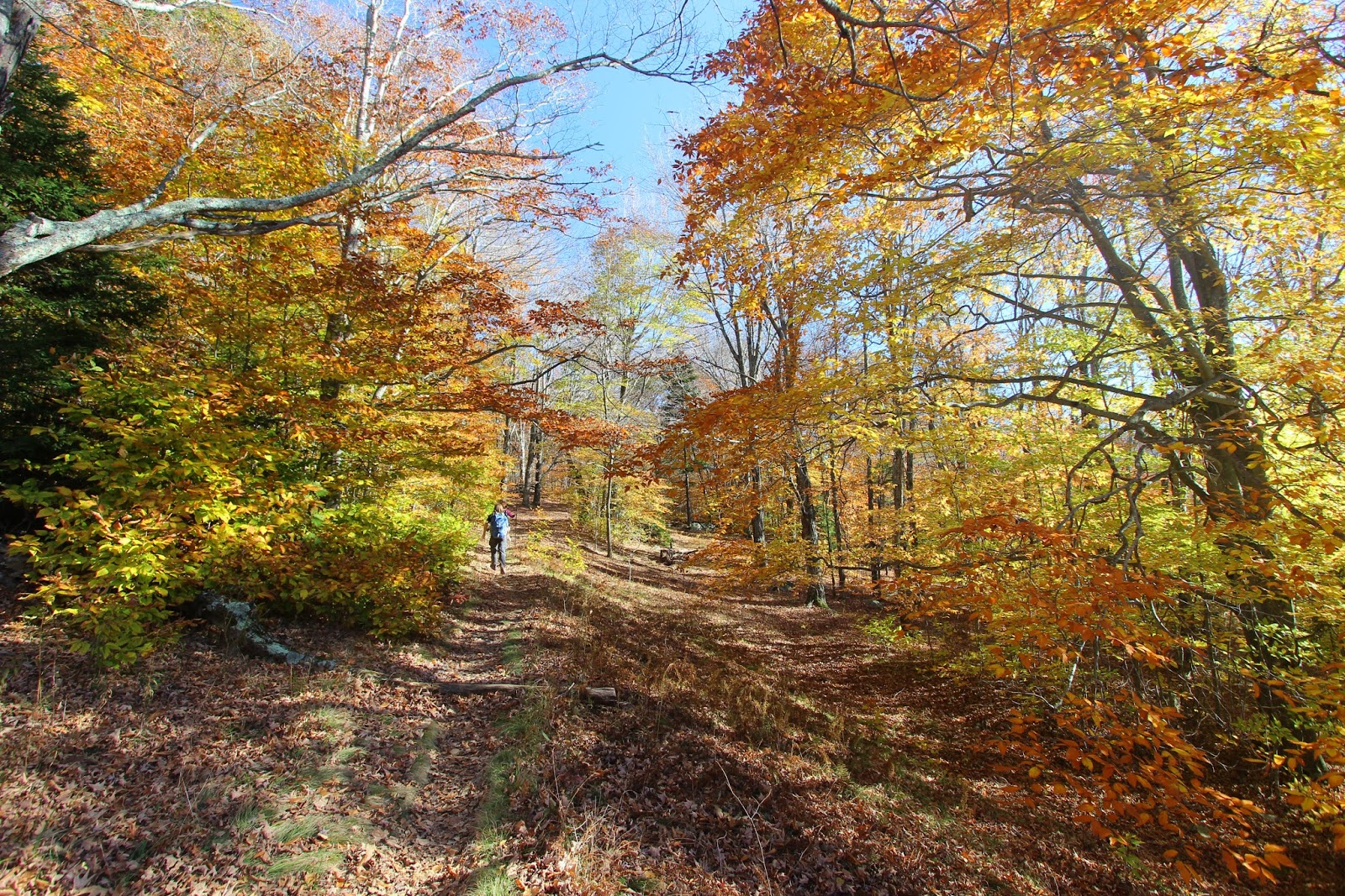
And were off...

Early in the year I hiked to Big Bald from Sam's Gap on a late afternoon run that was cut short at the top with blistering winds and cold weather, so when I awoke to clear skies and mild temps the day of the hike I felt even better about my choice. I picked Shane up at our usual rendezvous point and headed toward Spivey Gap. Shane asked me several times on the drive over how many miles the hike was and each time I would answer "12ish" he didn't seem to believe me and kept saying "Horton, I HAVE to be back to my truck by 3:30pm!" It's become kind of a running joke since considering I've yet to meet one of his time deadlines but I was confident today would be the day we would do it.
Footbridge early in the hike.
Shane passing by High Rocks.
Fall color at the spur trail to High Rocks.

When we arrived at Spivey Gap there were a few other cars which wasn't too surprising considering the nice weather. Shane and I hit the trail passing the first sign for Big Bald indicating it was 6.8 miles away. I pointed it out and said, "see, 12ish." The trail wasn't completely new to Shane as we had hiked to the first point of interest along the way earlier in the year. A little over two miles from Spivey Gap lies High Rocks and we had stopped by for some miles after a copperhead had turned us away on Whitehouse Mountain earlier in the day. I remembered the hike for the suffering climb and wasn't looking forward to it but the elevation profile seemed to calm down past High Rocks from way I could see online. Despite the short break from my longest hike of the year my legs were feeling good and hit the stairs up the first drainage a good clip ahead of Shane. When the trail leveled he caught up with me and we wound slowly up the mountain knowing we had some more tough trail before High Rocks. Across small foot bridges and stone stairs we began to get in a rhythm and soon we were at the thigh burning final push around High Rocks. When I finally started the downhill grade that passes in the shadow of the rock I was so relieved I paused for a minute to regroup before our next section that would lower us into Whistling Gap. The cruelest part about hiking on the Appalachian Trail is the amount of work you put into climbing a mountain before walking down the other side and having to face climbing another one. This stretch, as we would discover, would really test our mental toughness.
An old tree dominates the surrounding forest.
Another giant.
A peek of what's to come.

Heading into Whistling Gap Shane suddenly started laughing. I looked over to see him fixated on a tree with an unusual growth that looked like male genitalia. We both laughed pretty hard and of course had to take a few pictures before refocusing on conserving time. Hiking downhill we both shredded trail and before we knew it we were once again hiking uphill although it wasn't extremely steep. Between Whistling Gap and Little Bald the trail climbs, and climbs, and climbs. I seriously consider it some of the hardest hiking I've done. Each time I rose from doubling over holding my knees more trail rose in front of me and the horizon seemed to be running away. I was almost relieved to see Shane suffering as much as me. We both would occasionally laugh at how ridiculous the climb was before trudging on for a few more minutes. Miles went by, slow miles, in tenths and in torture. The trail started snaking wildly in switchbacks and suddenly I was on level ground. I waited for Shane to join me and we spent a few minutes of heavy breathing, knee holding rest, before he looked over and said, "Jason, I hate you."
The male tree.
Shane resting as we start the brutal climb around Little Bald.
Old fence as we continue to climb.

Just a few feet up the trail we were rewarded for our efforts. A small rocky cliff gave us an open view of the valleys below and mountain after mountain rolling away from us blanketed in beautiful fall color. The scene was almost as perfect as it gets. It's funny how you think you couldn't possibly hike another step buy then you get the view at the top and you're ready to keep on going. Shane and I both felt the energy and regained a little of our dignity as we crossed the top of the forest covered Little Bald and quickened our pace knowing there wasn't much climbing until the final assault on Big Bald. In the guidebook, theres mention of a shelter near Big Bald. The mileage was right for us to be passing it at anytime but all we found was more trail. I saw a tree with a sign ahead but found it only to be a water source. I didn't have a lot of water left so I left Shane as I followed the spur trail a few tenths of a mile before coming to a small spring. When I rejoined Shane he had scouted ahead with still no so sign of the Shelter. We were now about a mile past where it should have been and I was beginning to think we had somehow passed it when I seen the tiny building in the distance. Shane and I both were ready for rest and food and we settled in to the shade provided by the Big Bald Shelter. As Shane was digging out his meal I spent a few minutes flipping through the journal reading of other hikers hatred for the climb around Little Bald. A nice fire pit with some camping chairs set up around it was a short distance away and another water source was behind the shelter, much closer than the first one I chose to use. Shelters are often littered with graffiti but I like reading the various musings of other hikers on their journeys, so while Shane finished his Beanie Weenies, I was reading the walls.
Near the top of Little Bald, we finally got some views for all our work.
I had to take my camera out of the pack for this view.
Big Bald Shelter.
Resting up for the run to Big Bald.
Shane reading the journal.

The only remaining obstacle between us was Big Stamp. The rolling summit of Big Stamp has some climbing but nothing like we had experience on Little Bald and we eased up the trail among some twisted trees from years of high altitude weathering. Just ahead I heard some hikers and noticed Randy Tarpley taking some pictures of John Forbes dangling from one of the trees. They had drove in to the gated area below Big Bald and were hiking back to Spivey Gap. I've hiked with both Randy and John and so we stopped to visit a few minutes before climbing the remaining couple hundred yards onto the top of Big Stamp. The forest recedes and small shrubs pop out of the grassy summit. I noticed nets stuck in the surrounding trees and a pop up tent with tables and various supplies. Randy had warned us that the "birders" were up top and they were pretty loud. The tent was empty and as we popped out to our first clear view of Big Bald I could see a steady stream of people marching toward the summit. I'll have to admit, my heart sunk a little when I seen so many people but there's a good reason so many people suddenly appeared. Along the base of Big Bald is a large parking lot and it was full of cars and a school van, I couldn't help but think they cheated themselves by driving. The private Wolf Laurel community lies in the shadow of Big Bald and if you know the right people you can pass through the gate and park...half a mile from the summit. Even more frustrating was the fact that someone had driven into the field between the two balds and parked, ruining a picture of our approach.
Leaving the Shelter the trail was really photogenic.
Approaching Big Bald.
Big Bald heading to Big Bald.
Climbing higher along Big Bald.

Shane was undeterred by all the activity and set his sights on the top of Big Bald. He was so excited I could hardly stay with him as he stretched out to a lead winding up the mountain. The tiny stream of people we had seen were now just ahead of us and we both arrived at the summit hot on their heels. The group was students from a school in North Carolina and they all stayed pretty grouped together allowing Shane and I time to walk around and explore the summit uninterrupted. The views were much better than my previous trip and I was sure to take my time and get as many photos as possible. Shane wandered across the summit from the group of students and rested by leaning on his hiking stick staring deep into North Carolina, the picture of the moment was one of my favorites of the day.
Looking back to Big Stamp.
Shane near the top of Big Bald.
This was my favorite shot from the day.

We eventually settled into a patch of thick grass off the side of the trail near the students. We struck up a conversation with one of the teachers and he pointed out several different hawks to us as we snacked and enjoyed the views. As much as I wanted to just spend the rest of the day there, I had promised to get Shane home on time so I started packing away my gear for the hike out.
I found a spot to take it all in among the crowds.
Shane helps scale the summit of Big Bald in this shot.
The group of students posing for a group picture.

Strangely, my GPS was now over 7.7 miles and the 12ish miles I had promised Shane was suddenly looking like 14ish. We only has two hours left to meet his deadline and the pressure was just fun for me to see how much more hiking I had left in my legs. Down Big Bald and across Big Stamp our progress was temporarily halted by one of the bird watchers. She used a walkie talkie to communicate to someone further ahead of us on the trail and once the bird they were after was secure she told us we could hike on. Once we reentered the woods, I thought of Randy and John and wondered if our pace could reel them in. I kept check of our time and we were knocking down miles about every 16 minutes. Despite our torrid pace, I still would take time for the occasional photograph and we even took a few rest breaks along the way.
Gopro time from Big Bald.
I think the day was a success.

The climb back down Little Bald made me appreciate the climb up it even more. It seemed like we walked downhill for an eternity and when we leveled off in Whistling Gap I knew there was only one more uphill grade before we went around High Rocks. We were a little over 12 miles and the final push to High Rocks took a lot of our already tired legs. We had several more of the hold onto your knees and gasp for air breaks before finally walking by the shadow of High Rocks again. Another hiker was close to us for this part of the hike but there was still no sign of Randy or John. Once we began the last two mile stretch into Spivey Gap the other hiker couldn't touch our pace and we never saw him again.
Back in the woods.
It was a long day. Despite the look on his face here, he forgave me.
Finally back at High Rocks.

We finally popped out of the woods at 3:45 missing Shane's deadline once again. I looked down at my GPS to see we had hiked 14.96 miles and a stunning 4500ft in elevation gain. Although Shane and I were tired we weren't to the point of exhaustion we couldn't carry a conversation and relive our great day. As we slung our packs in the truck I recognized Randy's car still in the lot and wondered where we had passed them. It was another challenging hike but it helped put me at nearly 40 miles of hiking during my vacation and inched me closer to my 500 mile goal. Hopefully Shane didn't feel he "wasted" his day after it was all said and done...Until next time, happy trails.


Tuesday, December 15, 2015

On the home stretch to the 500 mile goal I knew there would be some days that I would have to pile up a lot of miles. I flipped through guidebooks and websites before finally deciding on a hike through the Grayson Highlands from Elk Garden to Fox Creek. The guidebook I used to plan the trip listed the hike at 17 miles and I knew it would take every ounce of daylight to complete. Also the hike would require two cars to shuttle us after completing our day so I enlisted my long distance hiking partner Amy Hall for the mission along with John Lane since he had been wanting to do a long day as well. I had bumped into John at Kingsport Oktoberfest and told him my plan and he was glad to take a personal day to join us and break in his new DSLR camera.
First picture of the day. Fox Creek parking lot.
Amy sandwiched between Jesus and the Devil. You can guess which is which.
First white blaze of the hike. Several hundred to go.
There they go, talking as fast as they are hiking.

The morning of the hike I met John off of exit 74 at Bass Pro Shops and we stopped off the Damascus exit to meet Amy. She was running behind as usual so we took the time to grab some breakfast and snacks for our all day hike. Amy showed up a few minutes later and led us to where we would leave her car at the Fox Creek trail head. Keeping up with Amy on the winding road was a real challenge and John said, "if she hikes like she drives it will be a long day for us!" We arrived at Fox Creek and jumped in the truck for the short trip back to Elk Garden some twenty minutes away. I had anticipated some vibrant fall color since we had passed through some gorgeous sections of trees on highway 58 from Damascus but when we crested the mountain at Elk Garden the trees were all stripped off their leaves already. The week before had been windy and rainy and it had taken a toll on the higher elevations. As John and Amy finished grabbing their gear and visiting the last restroom we would see for some twelve miles, I crossed the road and stepped onto the Appalachian Trail first and strode up the field scanning the horizon for the day ahead. The air had a chill in it but the sun was starting to rise from the valley and I knew we would warm up once the hiking started. Amy and John had never met before but were quick to get lost in conversation and they caught me at the edge of the forest passing me as they never stopped talking. I didn't mind trailing behind as I slowed my pace and took pictures to mark what would be the longest hike of the year.
This was tree was a whopper.
I tried to push the tree over but it didn't work.

The hiking was fairly easy and I didn't anticipate it to get any more difficult since Amy and I had looked at the elevation profile finding that there was only about a 1000ft gain from start to finish. White blaze by white blaze passed by and each wooden sign was a reminder of our progress. Amy had hiked the same trail a few years earlier but used it as a backpacking trip so she was able to tell us of points of interest before we arrived.  A blue blazed trail exited to our right leading out into a clearing with some huge boulders. Amy told me I would want to go out for a look and I scrambled on top of the largest boulder noting some of the more prominent peaks deep in North Carolina. Back on the trail we heard a jet approaching and as it screamed past it sounded like it would clip the trees. When we passed our first group of hikers of the day a few minutes later they said that it was most likely military related since Air Force One was scheduled to pass through later in the day. I didn't think about it at the time but the fact they knew that was a little strange, perhaps they were some undercover agents on the ground. John and Amy continued to lead the conversation but were kind enough to let me join in every few minutes and we shared laughs making the miles fall quickly and painlessly. The first four miles were in the books and we passed one of the biggest evergreens I've ever seen next to the trail. The base of the tree was split making a irresistible tunnel for us to play in. We all took turns taking pictures next to it before moving on. Within the next half mile we entered into the Grayson Highlands State Park and once again panoramic views greeted us as we trudged uphill through small shrubs and bushes. At the spur trail for Mt. Rogers summit a fellow hiker had stuck an American flag in top of the sign and Amy and John were treated to my rendition of God Bless the USA by Lee Greenwood. Apparently my singing was on point because they seemed to be re-energized as they quickly shot off toward the Thomas Knob shelter a short distance away.
Look at those views!
Mount Rogers spur trail. USA! USA! USA!
Thomas Knob Shelter.
John brings so much fun to a hike! This was next to the Thomas Knob Shelter.

At the shelter, we took time for a break. My heavy pack was wearing on my shoulders and it felt great to take it off for a few minutes. John and I shared a fiber bar and Amy lounged on the picnic table in front of the shelter. We didn't want to eat this early in the hike but our stomachs shifted our conversation to when we would have lunch and each of us had brought some special treats to celebrate our day. John had packed some whiskey in a water bottle and I had brought a single Highland Cold Mountain brew, Amy had ensured we would eat like kings having brought summer sausage and Butterkaise cheese. As tempting as it was to eat immediately I slid my heavy pack back over my shoulders and left the Thomas Knob Shelter in the distance. The trail winds through an ever changing scene inside the park, from craggy rock outcrops to thick laurel
tunnels it has a little bit of something for everyone. I really liked the section near Rhododendron Gap with towering pines and lush campsites, I could have just settled in for the rest of the day there. The arrival in the gap was marked by finding a nice rock outcrop that I had somehow hiked past in three previous visits. When I climbed to the edge of it I was stunned to find we were about seventy feet high from the forest below. I told Amy to be careful that the fall would be fatal and she slowly worked out to the edge as John worked his way to the highest point on the rock and began dangling his feet for pictures. I found a little dip on the cliff edge and leaned back in the natural chair to take in the view. To my left was Mt. Rogers looming over the surrounding mountains, it's rounded forest covered peak is the highest point in Virginia. To my right was the rising rock formations that make up Wilburn Ridge. It was truly a perfect scene and as I write about it months later it's as if I'm still sitting on that rock tonight. I took pictures from every angle and as thirty minutes passed it took Amy to get John and I moving again, in a classic school teacher move, she used the promise of snacks to get us back on schedule. We passed through Rhododendron Gap and headed toward Wilburn Ridge but I knew we would be slowed as I seen a familiar friend on the trail ahead.
Through the Rhododendron tunnels.
Some nice evergreens shade the trail.
Somehow John made both Amy and I look good. THAT is a nice camera!


One of John's reasons for hiking the Grayson Highlands was to see the wild ponies. The ponies are not really wild as they receive support from park officials and encounter so many hikers they hardly flinch when you approach them but they are still a sight to see with the surrounding landscape. John went into full kid with a toy camera mode firing wildly as he approached the ponies ahead of Amy and I. My attention shifted to something else as some Longhorn cattle were grazing just downhill from the ponies. It was the first time I had seen them in the highlands and I took a few pictures before deciding I should rejoin John and Amy with the ponies. As I mentioned earlier, I've hiked in the park several times but I never tire of the Highlands. We were approaching double digit miles and my legs felt great as bounced through the rocky portions of trail. Swinging around Wilburn Ridge the Appalachian Trail gets pinched through a narrow boulder pass known as Fat Man's Squeeze. It was so cool between the boulders that ice had formed and John and I took turns passing through while Amy waited on the other side to take our picture. The trail stays rocky as our pace slowed heading toward Massie Gap and the main parking area for the park. There were plenty of other hikers in this area and many of them took a second look at the giant and a man appearing to be Jesus pass by. When we finally passed through the gate exiting from Wilburn Ridge I was relieved to be off the rocky trail for a while and Amy decided it was time for a bathroom break from all the laughing we had been doing. She went off trail in search in some solitude while John found another group of ponies to photograph. I seen a small grove of trees and a fallen log and decided to rest there until they rejoined me. A rogue pony followed me to my resting spot and nosed through my pack before deciding to hang out with me in the shade. Amy finally returned and we were back to hiking and mercifully losing some elevation as we left the confines of the park. It took about half a mile before Amy realized she had left her hiking stick in the bushes during her bathroom break and John offered to go back and get it but she decided to go herself and sent us on in search of our lunch destination at the Wise Shelter.
Hey! Check out this rock!
Ok, work it John!
John had no clue. He was being harassed. A true professional.
John is really high in the air here.
A LONG way down!
The look of seduction. Mt. Rogers in the background.

A bit of my prankster youth returned and I decided to hike as fast as I could to beat her to the shelter and be ready to leave when she arrived. John stayed close on my heels and we swung downhill through laurels and toward the sound of water. In a few minutes we popped out of the woods onto a narrow foot bridge across a rowdy stream. I had to take a few pictures and as I finished putting up my camera, Amy came sprinting down the hill ruining my plans.  We hiked together once again following the creek downstream and with the lower elevations, we started seeing some nice color on the trees that had held onto their leaves. We found another tributary that fed into the main creek we were following and I took the time to filter some water to resupply for the remainder of the hike. The last trail sign I had passed listed the shelter as only a couple miles away but I don't know if it was my hunger or the terrain but it felt like it took forever to finally reach it. The trail passes by a nice privy and then a small side trail takes you over to the Wise Shelter. Once again a picnic table sits in front of the main building and the floor inside the structure was clean with a broom leaning in one corner and a plastic bag containing the trail journal stuck neatly inside on one of the roof beams. I threw my pack off my shoulders and laid back on the floor. John and Amy began to unpack their treats and I finally mustered the energy to start shuffling through my own pack. Amy clearly had the best selections and had brought enough for John and me to eat a hearty lunch. Besides her summer sausage and specialty cheese, she also had boiled eggs and pretzels. I had recently switched water bottles and found that my custom filter wouldn't screw on the top so I spent the first part of my lunch moving water into smaller empty bottles from my pack so that I could have something to drink besides beer or whiskey. John passed his bottle of spirits around and although it was strong it was refreshing after we had nearly eleven miles on our legs. I popped open the beer and we all shared our drinks and food as an hour passed before we even realized it. When the bliss of the food and conversation had worn off we had an empty pack of cheese, sausage, and our Whiskey was missing. It was hard to get motivated to go back to hiking but we were in a better mood and not very far away from the shelter we found a sobriety checkpoint. Amy cackled at the obstacle just repeating, "there's no way, there's no way!" A large set of wooden steps formed an upside down V that lifted us over a five strand barbwire fence. Somehow Amy gathered herself enough to make it across with John and I close behind. I was convinced the hard part of our day was behind us but I was wrong as the trail began to gradually climb lifting us around Stone Mountain. I was really sweating and was thankful I had replenished my water as we came out into an open field with a large herd of cattle. Normally I would have went to take some pictures but I kept trudging toward the growing ridge in front of me. When we topped over the rise in the ridge I could see down into a saddle in the valley and a lot of fencing, we had arrived at the Scales.
A look through Fat Man's Squeeze.

Heading on down the trail.
Where's the ponies?
"That's an interesting angle you chose there, John."
Wait! A longhorn!
This pony is not amused.
You guys go on, I'll stay here and eat this cow.
Seriously, I need food!
Nearing the Wise Shelter.

I couldn't fully appreciate the beauty of the area I was so gassed from the uphill hiking and spent the majority of the trip down to the Scales watching my step in the deeply rutted trail. Suddenly I heard another jet and caught a glimpse of a fighter jet flying dangerously low to the ground in the valley below the Scales. I grabbed the camera but it escaped behind a ridge but then I noticed another jet being flanked by two fighters high above us, could it be Air Force One? I told John and Amy that even Obama wanted to congratulate me on the longest hike of the year to both of them rolling their eyes. At the Scales, Amy visited the pit restrooms built on a side of the hill, I dare say that might be the most inspirational spot to take a crap in the mountains. John and I read the information board while we waited on her and I told him we should only have one uphill section of hiking left taking us the side of Pine Mountain for one last view before the descent to Fox Creek. The sun was beginning to sink low in the sky and the afternoon clouds were starting to turn colors. Amy caught us on the trail as we climbed toward an increasingly pink sky. Through the woods I had to take a few breaks as my legs were starting to wear down but John and Amy helped keep me motivated and soon the horizon that seemed so far away was getting closer and we finally leveled off as a spur trail shot off toward the summit of Pine Mountain. I knew the climbing was over and found a new energy as darkness started closing in on us. We all laughed and joked our way through rocky sections and small stream crossings before reaching the last shelter before Fox Creek. The Old Orchard Shelter had two AT section hikers having dinner in it. We paused briefly to visit and exchanged trails stories before leaving them to their meal.
Lunch time! Wise Shelter.
Time to dig in!
John up for the challenge of the whiskey ladder.
I believe I can fly!
"I did it, YESSSS!"
Another pony!
and another!
Hiking around Stone Mountain.
More rocky trail through the upland Bog.
John with the hat change at the Scales. Amy in the background emerges from the bathroom.
This is a quality fence. I know a good fence when I see it.

I had originally told John that the hike was 17 miles but my GPS was already nearing 17.5 and I told him I thought we might squeeze 18 out of the trip. He turned to me with a serious look and said, "Now wait a minute! I agreed to 17 miles, this extra mile is a deal breaker" before he broke out into a hearty laugh. Just before the parking lot and the safety of the car (not her driving) we crossed a small wooden bridge. Insignificant to most, to thru hikers it marks the 500 mile mark of the Appalachian Trail. I took a few pictures giving John and Amy time to make it to the parking lot ahead of me. When I finally came out of the woods and into the gravel lot they both were there to congratulate me and mark the occasion with a picture. I dug through my pack and found my Star Wars musical birthday card Amy and I had found on Viking Mountain and opened it up for a tune and some more laughs.
God I'm tired.
The sun fading as we work toward Fox Creek.
The 500 mile bridge.
The end. Nine hours and 18.7 miles later.

In all, we had hiked 18.7 miles through a rugged and tough terrain. We were tired but not exhausted and as we cruised back to Elk Garden we all talked of what a great day we had together. I stared out the window at the mountains glowing red from the last light of day. I was still a few miles short of my 500 mile goal but I had hiked the longest hike I've ever completed on what was only the second full day of my vacation. In my heart, I knew I had it in the bag. Stay tuned to see how it plays out. Until next time, happy trails!