A few years ago, armed with a machete and a head full of stupid, I led John and Shane into the Sampson Mountain Wilderness in an attempt to gain access to the remote and seldom visited Painter Creek Falls in rural Greene County. On that day we gained the ridge line of Sampson Mountain early on but found it to be a slow moving affair negotiating thick scrub and plenty of thorns before finally running out of daylight near a survey marker on the shoulder of the mountain. It was a great day of exploring but the disappointing sting of failure stoked a fire that burned silently inside me for almost four years. A few weeks ago Justin Hopkins asked me to join him on a hike. We kicked around a few ideas before he suggested somewhere new for both of us. When he said Painter Creek Falls I was quick to agree.
 |
A crude map of our proposed route.
|
 |
| The Sampson Mountain Wilderness is a bear sanctuary. |
 |
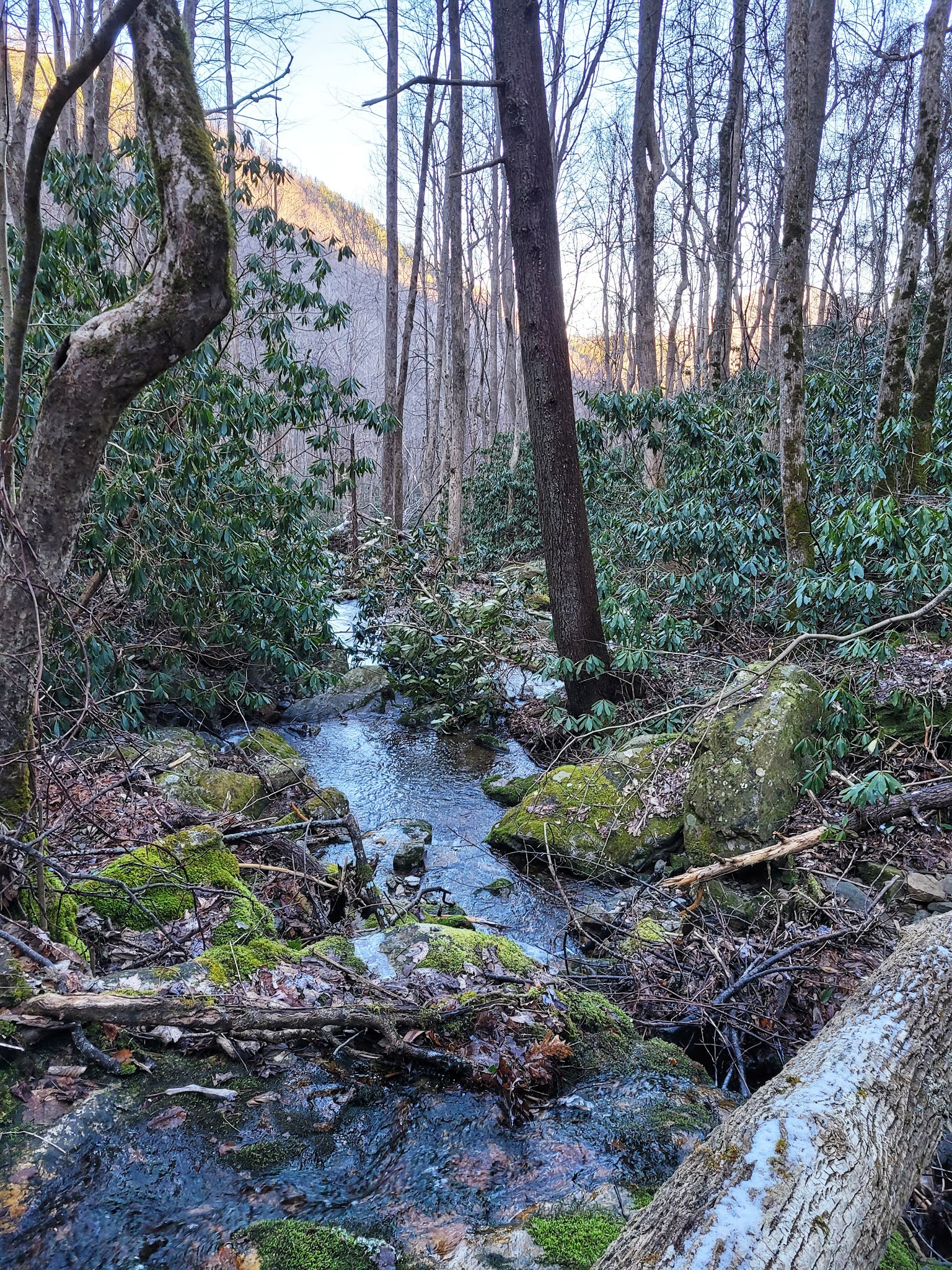
| Our route up and over to meet Sampson ridge. |
Justin is my greatest accomplishment as a hiker. We were friends through work and I invited him on a trip to see a few waterfalls in Erwin. After that trip, Justin found a love for hiking that even rivals my own and went on to be the first person to finish the North Carolina 500 waterfall challenge while also balancing work, marriage, and family. Occasionally Justin would have me join him on a "fun one" several that came to mind are the Raven Cliff Gorge of Upper Creek, The Road to Nowhere from Clingman's Dome, and now this monstrosity, where I was convinced he planned on finishing me off once and for all.
Painter Creek Falls is the largest waterfall in Greene County and a bear to get to. The last known people I have seen make the trip did so through private land over six years ago and had permission from the land owner. Justin and I would not have that luxury so it would require some map study and plotting in advance of our hike. I would like to think I've learned a little since my first attempt at Painter Creek, mainly the ability to read and use various map software on my phone to plot a course. Once I settled on the best route I still obsessed over the difficulty of what I had laid out for us to take on.
 |
| Justin leads us into the sky. |
 |
| I think it took us over an hour to three tenths of a mile. 1200ft of elevation gain can do that! |
 |
| As soon as we reached the ridge we found the largest bear track of the day....and Justin forgot his gun in the truck. |
We would start at the end of Clark's Creek road which is also the trail head for Buckeye Falls. The air was chilled and the ground beneath our feet was frozen after several cold nights in a row. I carefully checked my gear and started our track before taking one last glance back at the truck and attempting to find a way to keep my feet dry on the first of multiple unbridged creek crossings. Justin had no time for finesse and plowed through the creek while I found a rock hop path across further upstream. Our pace was brisk and we made easy work of the wide horse trail only slowing when I had to pick a dry way across the creek. Within the first hour we had blew by the turn for Chigger Branch Cascade as well as the Horse Camp where the trail finally deteriorates into more of a walking path. I'm not sure why I did it but I took a quick glance at our map and noticed the tiniest of finger ridges reaching down to make our approach what I felt like would be even easier than my initial plan. I showed it to Justin and we gazed up the steep bank but saw that woods were rather open and he agreed to give it a shot.
The woods were open but deceptively steep and beneath the fallen leaves were tiny loose pieces of shale making it two steps forward and one step back. The climb was slow and painful and Justin and I would ascend for about 60ft at a time before taking a break propped up against a tree to keep from falling backwards. It was difficult but we were having a blast retelling our many adventures and questioning our abilities to succeed on this daunting mission. After nearly an hour we reached a less difficult stretch of the ridge which followed a knife edge cliff we nicknamed Misery Point. We clearly weren't the only ones that thought this was a good approach as we encountered bear scat and plenty of paw prints in the snow as we inched closer to the top of the ridge. Once we topped out I looked back over our stats for the climb and realized we had gained over 1200ft in around .38 of a mile!
 |
| The ridge was narrow and it was easy to tell which side held it's snow. Unfortunately our descent would be on the snowy side. |
 |
| Looking back into Clark's Creek valley I could see Unaka rising up as we climbed higher. |
 |
| The final climb to the summit of Sampson Mountain. |
The spine of Sampson Mountain was coated in about three inches of fresh snow but the walking was heaven compared to what we had just done. Big views off into Clark's Creek valley on one side of us while views of the flat lands down near Greeneville on the other. Occasionally we would intersect animal tracks crossing the ridge with several deer, bobcat, and of course, more bears...including cubs. Several large trees caught my interest as we approached the true summit of Sampson Mountain and when I would stop to photograph them, Justin would cram snow into his now empty water bottle. As we drew closer to our last major climb both of us moaned from tired legs but we trudged up and over Sampson and set our sights on the drop off point a short distance further out the ridge. I honestly had my doubts up until that point of success but knowing it was all downhill to the falls gave me a boost of confidence although it would be short lived.
 |
| The bushwhacking begins as the slopes get steeper. |
 |
| Justin inspects his near disaster stump removal during our sliding from tree to tree. |
Reading my map app was becoming second nature and rather than climb the sister ridge of Sampson we kind of skirted along it's flank to meet a narrow spine that split Big Sugar Hollow and South Fork Painter Creek. From there we would simply stay with the ridge all the way down to the confluence of Painter with South Fork. Besides wading through wet snow we now encountered thick shrubs and undergrowth and it became evident the area had been struck by a wildfire sometime in the last decade. Not only was our progress painfully slow, it became painfully painful due to the thorns interspersed among the jungle. I begrudgingly took the lead and worked my way down the ridge like a human bulldozer. Our conversation ground to a halt and we focused on getting to the creek as we now both were out of water. A glance at the map showed we were closing in on a nearly 800ft steep descent with several bands of cliffs to deal with before reaching our prize. I was exhausted from plowing the way down so I turned the lead over to Justin and told him to just keep heading down. We didn't make it far before the snow and grade was too steep and too slick so we decided to ride it out by sliding on our rear ends from tree to tree all the way to Painter Creek. Our plan worked pretty well although we moved at a snails pace to ensure we didn't blow off the side of an unseen cliff. At times it was fun and we both laughed as often we would pick up too much speed and end up turned backwards or sideways precariously holding on to anything that would hold us. A hidden stump almost gave Justin a free vasectomy and the look on his face was one of concern as he glanced back at me.
 |
| I left a trace. It's hard to stop 365lbs going straight downhill. |
 |
| Our last obstacle was this nearly dry cascade. We inched our way down each natural step. |
The terrain remained steep and we started running into cliff bands that made me worried we may get trapped if we stair stepped down one and found it too slick to climb back up with the snow, so I adjusted our plan yet again. I noticed an unnamed tributary on the map parallel to South Fork and it looked less formidable, so I told Justin to angle right as we descended to intersect it instead. It didn't take long until we were nearly 40 vertical feet above the safety of the trib, Justin went first down the final slide sticking the landing and letting out a victory yelp as he could finally refill his water. As he turned his attention to his bottle, I attempted a similar manuever but lost control of my hiking stick and it shot down with laser precision and stabbed Justin right in the back of his calf! I don't know why I thought it was so funny but I immediately started laughing and it helped break up the tension from the steep slide from near the summit of Sampson. Eventually I stopped laughing long enough to check on Justin as I also filled my water bottle from the bubbling stream. He didn't find it as humorous as me but he wasn't severely injured, so we turned our attention to reaching the main creek.
 |
| Rocky terrain is always a good sign of a waterfall nearby. |
 |
| The land before time. |
Below us was as close to a path as we had since leaving Clark's Creek. The small creek was fairly open and I felt by continuing to follow straight down the gut of it would give us our best chance of success. Only a step or two into the descent Justin fell and his groin muscle seized up on him causing a mild delay and a hilarious conversation that can't be repeated here. After Justin got back to his feet we made short work of the tributary even climbing straight down a 20ft stairstep cascade. The final few feet before we reached Painter creek was a sea of grapevines with sizes unlike I had seen before. The entire area had a land that time had forgot feel as I rock hopped Painter Creek and turned my attention upstream to the confluence and our prized waterfall location.
 |
| Climbing toward Painter Creek Falls. The lower drops are impressive in their own right. |
 |
| The main drop of Painter Creek pretty much covers the entire ridge. |
Virgin timber was hidden deep in this hollow with large hemlock and tulip poplar that would impress even those that had seen the Smokies giants. As much as I wanted to inspect each one, daylight was fading and we had yet to the see waterfall. According to my map, I was now only 500 feet from seeing Painter Creek Falls but there was no sign of a trail so I scrambled among the now house-sized boulders and through the thick laurel on either side of the creek. A particularly pesky limb caught me by my pack causing me to face plant in the rememnants of snow and for a moment I laid there grateful to be off my feet and unusually at peace. It had took a herculean effort to reach this spot and I was beyond gassed. My brief rest was interrupted by Hopkins letting me know we were at the base. As I gazed up the mountain I saw a rock obscuring my view but behind it was the main flow of the 200ft waterfall. I scrambled up to join Justin and soak in the scene. Painter Creek is squeezed to a narrow chute spitting water out about 15ft before spreading out and cascading down another 70ft or so, it was everything I could have asked for. Justin and spent the next thirty minutes jockeying for position for photos and videos before reluctantly turning our attention to South Fork.
 |
| Justin approves of our suffering. |
We both knew there were several waterfalls on South Fork but we also knew we had an uncertain escape from darkness across a snow covered and dangerously steep mountain. Again I adjusted our plan and offered a more sane escape plan following Painter Creek out near it's intersection with private land and bushwhacking to a getaway car pick-up along 107. Justin was as tired as me and quickly agreed to go for it. We worked our way downstream still not seeing any signs of trails. Sometimes we would find an old logging road but it would fizzle out and we would be forced to creek walk due to the thick vegetation on either side. The progress was excruciating slow and I wondered if we would make it out when suddenly, and a good distance downstream, I saw a bridge and not just any bridge, a well constructed, expensive, and private land bridge. We carefully skirted our way around the area and soon found a paved road beneath our feet. Several miles later, we collapsed alongside highway 107 awaiting pick up from my wife who was pretty angry to give up her spot on the couch to come rescue us.
 |
| Our path downstream was nonexistent. |
 |
| Awaiting our rescue. |
When Amber wheeled in beside us about 30 minutes later she greeted us by saying, "What's up, dumbasses?" Justin and I both laughed and admitted she was probably right but we had fun, accomplished our goal, and most importantly, lived to tell about it. God only knows what crazy idea we will dream up next! In closing, don't attempt this...seriously, and as always, happy trails!


Stump Removal Advance, NC , provides expert and efficient stump grinding and removal services for a clean and polished landscape. Old Goat Land Services delivers professional land-clearing solutions, ensuring your property is safe and ready for use.
ReplyDeleteCool
ReplyDelete