***See day one just below this entry***
Day two Steve and I awoke to beautiful weather and sore feet, but the excitement of a return trip to the Virgin Falls Pocket Wilderness outweighed our pains. I carefully bandaged my feet and put on two pairs of socks for extra padding while Steve tried to squeeze just a few more minutes of sleep out of the night. We ate breakfast and made the short trip just outside of town to the trail head for the Pocket Wilderness. The drive to Virgin gave us a cheap bonus falls, as we crossed over the Plateau, Wildcat Falls is literally beside the road. We pulled off and got excited to see it actually flowing this time, last year it was just a rock cliff.
 |
| Wildcat Falls. |
 |
| Honeysuckle bloom. |
 |
| Big Branch Falls. |
 |
| Arrival at Big Laurel Branch. Trail turns right heading down to the falls. |
When we got to the parking lot we were one of only three cars, also another exciting development. The first half of the hike is easy because it is a gentle downhill hike for four miles, the problem is hiking back out that gets many hikers in trouble. We had packed plenty of food and water and although the packs were heavy, I knew it would be worth it. At just over a mile into the hike the trail picks up Big Branch. The creek has a low drainage and was bone dry last year so when I could hear the creek before we got there, I knew we had picked the perfect time to come. The trail follows the stream for a short time before losing elevation rapidly beside of Big Branch Falls, a small but beautiful 20ft drop. We stopped briefly, lining up a few photos before making the next mile toward Big Laurel Cave and Falls.
 |
| First view of Big Laurel cave and Falls. |
 |
| Big Laurel Falls. |
 |
| Steve entering Big Laurel Cave. |
 |
| Inside Big Laurel Cave the creek running backwards toward the back wall. |
 |
| No water downstream from Big Laurel Falls. |
The trail begins a long grade downhill before meeting Big Laurel Branch. There are steps, and MORE steps, each one being a reminder of having to return the same route. This stream is much larger than Big Branch and several tempting swimming holes are passed on the way downstream. The trail enters a boulder field just short of the falls and descends around some rock steps leading down to the base. The air temperature changes drastically at the entrance to Big Laurel Cave just behind the waterfall. Big Laurel Falls is one of the most unique places I have ever been. The creek falls over cap rock about 40ft before draining backwards and downhill vanishing into the cave behind it. The large cave entrance shrinks near the back wall and is barely big enough to wiggle though as you can hear water draining far below your feet. It's also a perfect spot for a break, so Steve and I lightened our packs a little having some water and crackers. The cool air made it hard for me to want to get back on my tender feet and continue on, but Steve was so giddy he made me anyway.
 |
| Steve entering the sinkhole at the base of Sheep Cave Falls. |
 |
| Upper section of Sheep Cave Falls. |
 |
| Steve inside of the Sheep Cave. |
The trail quickly leaves the falls and the sound of water all together, the occasional bird was the only sound for the next mile. The trail arrives at a fork with the left fork leading downhill toward the sound of the Caney Fork River and the right fork stays fairly level to the right crossing the next ridge. The right fork also takes you toward Sheep Cave Falls which me missed the last time we came to Virgin Falls. We hiked what seemed like an eternity before crossing a small hill and entering a massive sink hole. The lower rung of Sheep Cave Falls could be heard through some trees along the cliff, but my eyes were fixed on the ominous black hole at the bottom of the sink. Steve and I found a trail that descended further into the sink. The ground was soft and eventually the trail turned vertical and I decided I had went far enough. Steve continued on and found a small rock shelf just before the cave's vertical drop. I retreated to the main trail and began climbing around toward the sound of the falls. After Steve failed to join me, I went back to check on him he was just getting back to the trail and had a look of fear on his face. He said he had made a bad mistake entering the sink and from what he could tell there was no floor or hope for survival if he had fell in the cave. We hike together to the next section of falls, which is unique but really difficult to photo safely. The middle section of Sheep Cave Falls drops 50ft through a vertical shaft it's carved in the rock and vanishes beneath your feet before emptying in the large cave at the bottom. The trail is STEEP and we both held on for dear life using trees to absorb our weight on the climbs around the falls. The upper section of the falls is the most beautiful part cascading over 30ft in a more peaceful setting. Just above it, is the entrance to the Sheep Cave so Steve got his flashlight and entered the cave noting that there was another waterfall coming in further into the cave but the waste deep water kept us from exploring further.
 |
| Virgin Falls. |
 |
| Heading down into the sink. |
 |
| This was as close as I could get without ruining my camera from the mist. |
 |
| First peek into the Virgin Falls Cave at the top of the falls. |
 |
| The top of the falls in the distance. |
As we hiked away from the Sheep Cave I was relieved to be back on level and safer grounds. The trail continues the downward trend and soon winds around a ridge where the roar of water greeted us both. A few minutes later I could see Virgin Falls through the trees, it was like a mirage in the forest. The falls were absolutely perfect for photography, the flow was much fuller and the sun had yet to come over the trees. I was in stunned silence in the presence of something so wonderful. There were a few people who were at the falls when we arrived and they seemed irritated to see someone else. Steve and I could have cared less and quickly were taking pictures and exploring the sinkhole around the falls. We took a break on a log near a campsite to view the falls and have another snack. One of the other hikers was seated to our right and appeared to be writing in a journal and referencing his bible between writing. He was perhaps the most hateful looking and unfriendly hiker I have encountered. We had yet to climb to the top of the falls (we were too tired last time) so we took the rutted path to the left of the falls toward the top. Near the top we found a small side path that led us out to the brink of the falls and a very tempting rock hop to a dry shelf behind them! The only problem was if we missed the rock hop we would be killed, and we decided we still had falls we wanted to see and climbed to the top of Virgin Falls. The creek emerges from Virgin Falls Cave just upstream and we climbed down into it's entrance hearing the roar of another hidden waterfall in it's depths. I can not think of a more perfect waterfall I have ever seen and I was sad to have to begin the hike back to civilization. Maybe one day someone will bring my ashes there letting me wash over the falls and into oblivion.
 |
| Steve at the main entrance to Virgin Falls Cave. |
 |
| Steve was so happy I thought he would jump. 110ft drop just in front of him. |
We both had better conditioning this year, and we absolutely blistered the four miles back to the truck arriving in only an hour and a half. The arrival back at the truck by 1:30pm gave us a lot of opportunity on the backside of the day and we grabbed a quick lunch before heading to Lost Creek Falls.
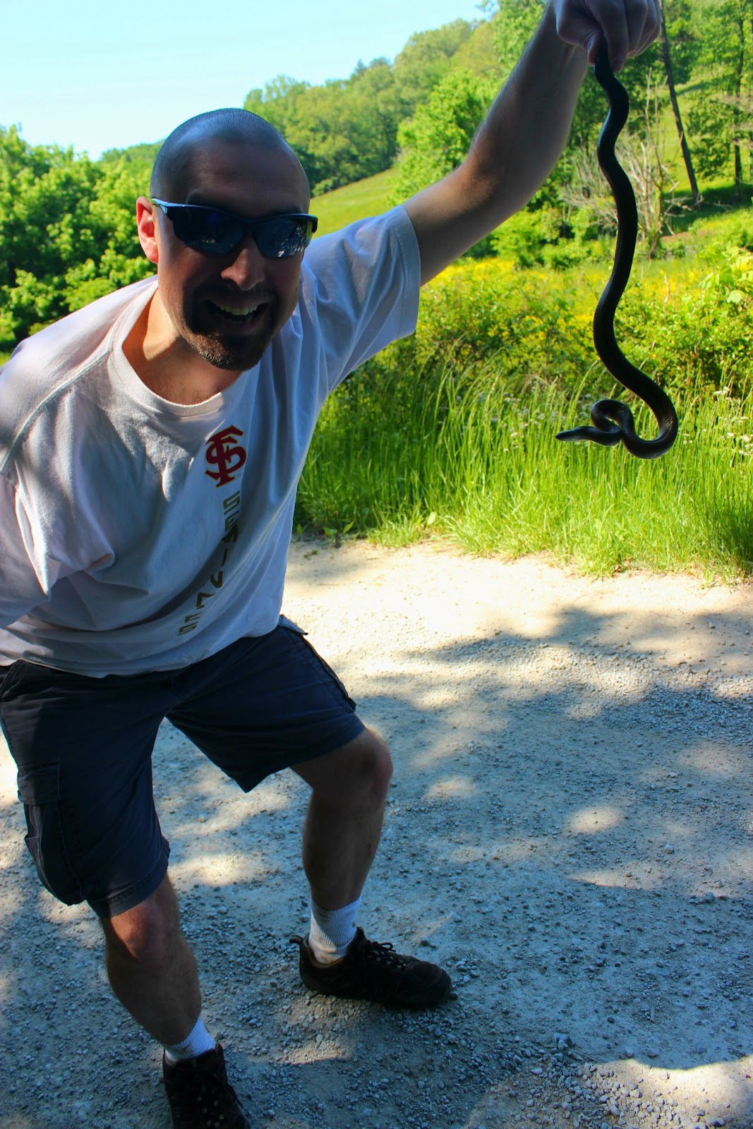
 |
| Our first capture of the trip, although small, he was a fighter. |
 |
| Entering Dotson Cave. |
 |
| Further into the cave. |
 |
| Lost Creek Falls. |
Lost Creek Falls is kind of remote compared to the other falls we had visited and we traveled through a large flat bottom field for what felt like forever before the road entered a forest and came to another large sinkhole. Lost Creek Falls tumbles 65ft between a rocky cliff entering Wild Dotson Cave 100 yards downstream. The cave is equally impressive with it's entrance being large enough to accommodate a semi. I had read in the guidebook that scenes for Disney's Jungle Book where filmed here and I could see why. The setting reminded me of a rain forest and the humidity was brutal. The moisture had benefited the area though with lush green plants everywhere. To the left of Lost Creek Falls a small stream enters and cascades over 30ft making a nice falls that is not listed in the guidebook. Steve and I both still felt great and decided we should ride on over to Fall Creek Falls since we were so close.
 |
| Rockhouse Falls |
 |
| Long swinging bridge crossing Cane Creek Cascades. |
 |
| Cane Creek Cascades. |
 |
| Fall Creek Falls. |
Fall Creek Falls is over 26000 acres and upon entering the park from any of the five entrances you still are a twenty minute ride from seeing a waterfall. We visited the main falls first which falls 236ft into a large rock amphitheater. We had hiked to the base before so we just photographed it across the gorge which was just as good photo wise. Coon Creek Falls to the right of Fall Creek Falls and was a lot smaller but still nice to see a waterfall that size in person. We traveled over to the nature center which is built right next to Cane Creek Cascades. The last time we visited the Cascades were covered in tourists but with only a few cars in the parking lot we emerged from the creek bank to see the falls were all ours. A large swinging bridge crosses the top of the falls and I think adds to the pictures. Just downstream from the large cascade Cane Creek Falls drops 85ft into a deep large pool. We hiked around to the overlook for Cane Creek Falls and found the trees to have grown in really restricting the view. To the right of the overlook is Rockhouse Falls which pours over 100ft into the gorge below. I was able to lean over the guard railing and with my long arms, snag a good photo. We still had a few hours of daylight remaining so we traveled back toward Sparta making a side trip to Rock Island State Park.
 |
| The Great Falls at Rock Island. |
 |
| Rainbow in the mist. |
Rock Island State Park seems to be underrated compared to the other parks on the plateau but I was impressed with it. We arrived at the overlook for Great Falls just below the river dam to see a waterfall that stretched over 500ft wide and the river varied from 25 to 35ft drops. We quickly found a trail to the base and a sign that caught our attention announcing that 102 people have died from drowning here. We passed a nice side stream falls that isn't mentioned in the guidebook and arrived along the river on a large rock shelf. We stair stepped our way down to the river level and the full size of the falls could be appreciated. The raging waters would no doubt crush anyone that fell in. I soon spotted Twin Falls downstream on the opposite side of the river. I asked some teens how we could get to them and they gave us directions to the overlook.
 |
| That should get anyone's attention. |
 |
| Side falls on the way to the riverbed. |
 |
| Looking up river at the Great Falls. |
 |
| Leaving Great Falls and heading to Twin Falls. |
Twin Falls isn't a naturally occurring waterfall, when the river was dammed forming the lake, waters rushed through the caves causing waters to pour from the side of the mountain. Geologists determined the hillside wasn't a threat to collapse so Twin Falls is now a permanent fixture. It was getting late and the sun had just set behind the hills. The waterfall looked magnificent and with it being our final stop of the day we rested along the river bank recounting the days hiking.
 |
| Main drop of Twin Falls. |
 |
| Twin Falls. |
All told, we had seen 16 waterfalls in one day. A new personal record and one I think won't be topped. I was tired but I was so happy with each trip and the laughs and stories along the way. As the last light of day faded we drove away from Rock Island and maybe set a record for most expensive Taco Bell order before getting back to Sparta and our hotel. I took a quick shower and loaded a few pictures before falling asleep with my computer on my lap. To be continued....