Monday, April 29, 2013

I have never understood people's obsession with the Great Smoky Mountains, it's far too crowded for my liking, I have always been the type person that prefers seclusion to socializing, especially when I hike. Recently, I have had a change of heart. I have completed the Rainbow Falls, Chimney Tops, and Ramsey Cascades hikes and have loved each of them. The surprising part is the difficult and ruggedness of each trail despite the thousands of visitors each year. So last Thursday I chose an eleven mile round trip hike that has been billed THE hike to take in the Smoky Mountains.
The start of the Alum Cave Trail
Here comes Jeff!
Arch Rock to the right.
Steps leading through Arch Rock
Top section of the steps.

The Alum Cave Trail is insanely popular and known as the ultimate Smoky Mountain sampler, so it was no surprise for Jeff and I when we arrived at the trail head and found the lots to be full and we had to park along the road on the opposite side. Our spirits stayed high because the thick cloud cover that had plagued us on our way in was breaking up rapidly and bright blue skies were peeking through. Jeff is one of the obsessed with the Smokies folks I mentioned earlier and had already vanished over the road bank toward the trail head by the time I got my pack and camera gear ready. The temperature was brisk that morning and the road was wet from a passing shower. I hiked quickly to catch up with Jeff and found him at the long bridge that starts the Alum Cave Trail or as I will call it, the ACT.

The trail turns rocky near Inspiration Point.
Morning fog lifting near Eye of the Needle.
Eye of the Needle using the 250mm lens.
Same spot but with 18-55mm lens.

The first mile and a half of the ACT is easy and follows a really nice stream, there are a few foot bridges along the way and the second one brings you to the first point of interest. Arch Rock is across the bridge and the trail goes through it! A staircase rises through the rock tunnel and emerges on the other side. Jeff had been here before but failed to illustrate to me just how unique it was, and despite the crowded parking lot, we had it to ourselves for pictures. The trail remains flat for another half mile before turning away from the stream and begins the climbing toward Alum Cave. The sun was beating down on us in our warm clothes and at each shaded area of trail we paused for water or trail mix. The trail has a few switchbacks before rising to a sharp hairpin turn at a beautiful clearing, hikers have bestowed this spot with the name Inspiration Point. A rocky spined ridge is directly across the gorge and middle ways up the ridge is the Eye of the Needle, a large hole from one side of the cliff to the other. The remaining clouds from the morning rain were lifting when we arrived and made for excellent pictures. I checked the GPS and noticed we were less than half a mile from the cave. The trail continues to climb and a long set of wooden steps takes you into Alum Cave. The cave is not a natural occurrence, years ago, the spot was mined for the ingredients for Epsom Salts. At least half the people from the parking lot were here and were lounged about in different places having snacks. The grade underneath the rock shelter is steep and I about face planted in front of them all. I found a small rock to rest and look out over the Smokies, for most people, their hike ended here.
Near the entrance to Alum Cave.
Inside of the cave, you can see the rail helping hikers on up the trail.
The start of the cable runs.

Jeff must have been feeling good because he was first to his feet and toward the far left side of the cave and the continuance of the ACT to Mount LeConte. A sign indicated that we still had another 2.7 miles to the summit and I knew we were in for some suffering between the cave and those sweet porch rockers at the LeConte lodge. We moved briskly and passed several other hikers as started seeing the first of countless cable runs up the mountains. The cables are in place for your safety, over the years several rock slides have scared the mountain leaving a narrow passage from one side to the other, a few of these were a little nerve-racking. I checked the GPS as we passed the 4.5 mile mark and Jeff's legs were starting to fade. I scouted on ahead as he rested and found another slide area with views that were inspiring to say the least, I yelled back to Jeff and when he caught up he was equally impressed. The epicness of the moment refreshed us and we made a decent push into the fifth mile. The final cable runs were so high in the air icicles were dangling from them. We journeyed under a large cliff with low clearance (especially for me) before the trail finally and mercifully leveled.
Taken from one of the huge rock slide areas.
The upper portion of trail in the slide area.
Fantastic views of the Smokies.

The final half mile to LeConte Lodge was more of a coronation than a hike with us both relieved to have the climbing behind us and in a matter of minutes we were seeing the roofs of the shelters popping up along the trail. A large staircase led us down into the center of the lodge and the dining hall was straight ahead of us with the date and elevation posted above the doors. We visited the office and I had to get a few souvenirs before settling into a rocker on the porch and enjoying the views back toward Pigeon Forge and the less mountainous areas below. Jeff toured the lodge and picked out his cabin for his return trip in June. It was chilly now that I was sitting still and I noticed a thermometer on the wall behind me was pegged on 40 degrees. I gathered my belongings and wandered down to the dining hall and entered it, the sign on the wall said it seated 75 people but I was more interested in the stove and the heat radiating from it. I warmed my hands and took some pictures before joining Jeff for the return trip down the mountain.
Ice accumulated near the last cable run before the summit of LeConte.
The never ending climb.
Looking back for Jeff.
Finally the top!
Amazing views, almost dream like.
Heading to the lodge.
LeConte Lodge
Jeff at the dining hall. Notice the date and elevation.
The view from the office porch at LeConte Lodge.
I made it!
Heading home.

The hike down was a breeze compared to the uphill drag we had just done but after three miles of nonstop descent my legs were jello and my big toe was on fire. We continued to move at a fast pace and arrived back at Alum Cave to find we had it to ourselves! When we finally made it to the creek again my legs were hiking on instinct, the conversation had ceased and we both trudged the two miles to the truck almost speechless with the occasional "whew" as our only banter. I don't think I have ever felt better as I took the pack off my tired shoulders and threw it in the back of the truck, we both were exhausted but had done what had been a dream hike for us both. The weather couldn't have been any better and we both had cameras loaded with pictures. The ACT is a must for any hiker looking for the best that the Smokies has to offer, just don't go unprepared or unmotivated or you will never make it. Until next time, happy trails!

Monday, April 22, 2013

I have had the worst writer's block when trying to summarize my last few hikes. I take as much pride in the writing as I do the photography involved in the blog, so to say I am frustrated, may be an understatement. Yesterday, I took a hike that I have been meaning to get around to for 33 years. The rocky cliffs on top of Clinch Mountain near Gate City have always caught my eye and with a tour guide like Daniel Barnette, the time was right.
Ewing Chapel at the base of Clinch Mountain.
Amber's face after realizing there is no trail. Cash has the same face.
This was a "mild" section of trail
The long brutal grade.

There isn't a real trail and I don't know if it is on private property or not, all that Daniel would tell me was once we got in the woods, he could get me to the top of those boulders. The first part of the hike was a bushwhack as we pushed up the mountain with his girlfriend and my wife's gripes as our background music. Across a small stream, I saw the logging road that we took to the top of a sharp ridge. The ridge had a really narrow spine and dropped off steeply on either side. Daniel spent a minute looking around and said "we need to go up here" We left the logging road up a rutted bank and into the woods. The forest was open so we continued up the hill at a decent pace considering the terrain. Daniel told us that we were entering a difficult section of trail and that it would get better at the top. The long incline took my will to hike at about the halfway point. My legs were burning and my lungs were on fire from gasping for air. Amber and Keisha struggled too and fell behind, but Daniel kept us motivated and promised, in the end, it would all be worth it. At the top of the long grade the mountain rounded off gently. My excitement of having it behind me was quickly soured with the realization that we were going to be hiking downhill for a short period before climbing at a near vertical rise for the final push of trail. I have hiked in seven states, extreme conditions, and I have to tell you, that climb is unmatched.
The cliff climb and the natural staircase.
Weber City on the left and Gate City on the right.
The first Food City I worked at.
Amber and Cash looking over Weber City.

As I stumbled up to the base of the cliffs on the mountain, I could look back across the opening in the canopy and see all of Gate City and further than I had ever thought possible. Daniel was resting with Keisha at their base and I cheered Amber on to join us. We all rested in the shade of the cliffs and I started realizing we were in for some more difficult climbing. A natural rock staircase helped us up the first portion of the cliff before we had to scale across a narrow path to a steeper climb up and back to our left toward the summit. As the faint path winds toward the top, the first large rock juts out of the mountain and I hugged it thinking of how many years I have stared at the very spot from the base of the mountain. I could see that we were already above Bays Mountain and Daniel encouraged us to keep going that the best was yet to come. As we walked along the edge of the cliff Daniel vanished over the side of the mountain and stepped out onto a large flat rock that I recognized from all previous photos I had seen. The views were great and it was a perfect resting spot being shaded by a few trees. A small cave was off to our right and Daniel and I took turns looking down into the darkness. He said there was another rock he had not found on previous hikes and left us to rest and regroup.
Daniel and Keisha checking out Gate City.
The large flat rock that most people mistake for the top.
Daniel entering the cave.
The true summit of Clinch Mountain.
Surreal view of Gate City.

After about ten minutes he came back and said he had found an even better spot and tried to convince us to go. The girls weren't too thrilled with this development but after I got up they decided they would join us as well. We climbed once again and after about ten minutes I saw a large object that looked like a cloud through the trees. The large cloud turned out to be a boulder that was balanced out over the cliff at a sharp angle. The views from here were truly worth the struggle. I could see mountains that I knew were in North Carolina as well as the faint outline of the Smokies in the distance. It had turned out to be a perfect day for photos and optimal views with the slight cloud cover.
Daniel in thought.
pretty big lizard on the mountain.
First ridge on the horizon is Bays Mountain.

As we packed up from photos and one last snack, the sense of accomplishment that I felt was overwhelming. It is a struggle to the top of Clinch Mountain, but some things worthwhile in life are just that. Enjoy the photos, this one was a one and done hike and I won't be back. Until next time, happy trails!
Coming down the cliff.

The cliffs near the summit.


Daniel on the other end of a hollow log.


Monday, April 15, 2013

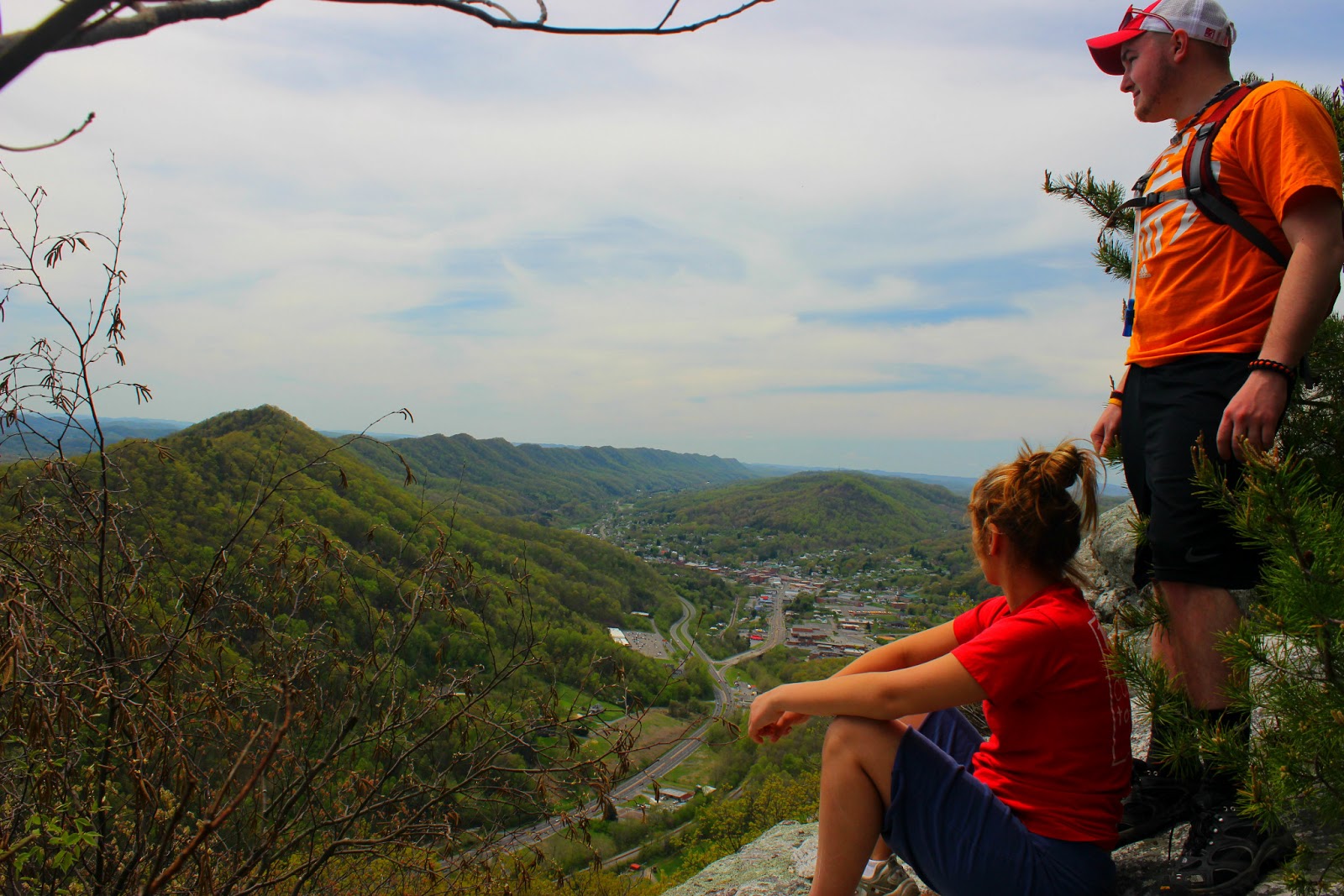
I last set foot on Grandfather Mountain twenty eight years ago. I really don't have a good excuse as to why I haven't been back but I have tried in recent months to make the trip. On two separate occasions, I arrived at the gate to find the park closed for weather conditions even though there was no snow to be seen anywhere. The frustration from those trips added to  my desire to go back even more, and yesterday, I finally got to throw my $18 bucks in the pile and head toward the towering peaks and world famous swinging bridge.
The view near the swinging bridge parking.
Just above my shoulder is Hump Mountain.
On the swinging bridge.
Amber on the far side of the swinging bridge.
Pooled water on the Grandfather.
The small sign at the bottom is point of no return and site of two deaths.

When you mention Grandfather to most people, the first thing they mention is the mile high swinging bridge, but I was more interested in the hiking trails, particularly, the Grandfather Trail. The trail is known as one of the more extreme hikes in the south with cables and ladders helping hikers up and over the massive peaks on the mountain. Steve and I were excited to tear the trail up and scratch another goal off our hiking bucket lists, but the girls were more interested in the animal exhibits and swinging bridge.
Find Steve, it's not that hard.
The legendary swinging bridge atop Grandfather Mountain.

We spent the first part of our visit playing on and around the swinging bridge. Many people think the bridge is a mile high above the drop which it's not. The measurement comes from the bottom of the mountain and at the midway point in the bridge you are 5, 280ft above the ground, or one mile. The bridge was wooden when I visited as a child, but has since been upgraded to a metal structure that still features some pretty good movement and when the wind howls through it, the sound is deafening. I had mentioned when we were coming up the mountain that a scene from Forrest Gump was filmed in one of the curves near the top. Steve was thrilled with this and demanded we visit it and recreate the scene of Forrest running around the curve. The park service doesn't allow parking or walking along the road but we were able to sneak off trail and set up the cameras for Steve to come running by with the look of delight plastered all over his face.
Some curves near the top.
The high point for Steve yesterday.
Step out into Heaven.

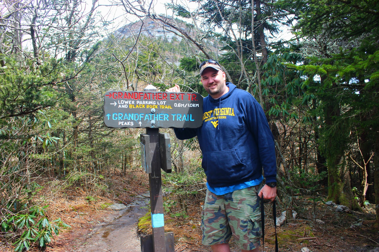
It was already early in the afternoon when we finished and I knew the trails closed at 4pm. You can't park at the top of the mountain to hike the trails because of the many people that want to visit the bridge so we had the girls drop us off at the top at the Grandfather trail head and they went down the mountain to visit the animals. As we left the parking lot, a park employee greeted us at the start of the trail, he told us that we could hike as far as Macrae Peak but that we shouldn't continue past that point with our footwear due to four inches of ice accumulated on the shaded backside of the mountain! I agreed and asked where the trail was and he pointed up a rocky ravine with a blue blaze on rocks up the ridge and out of sight. I laughed at the prospect of what awaited us and started hopping from rock to rock up the trail. At the top of the ridge the trail flattened and winded through the forest at a peaceful pace. We arrived at the first attraction known as the Patio and found a wooden bench and views of Macrae's Peak rising steeply above us. The trail headed downhill and under some large boulders that were difficult for me to walk under. Soon after we arrived at the first set of cables bolted in a large sloping uphill rock. We made it up with no problems and wound into a larger rock field and in a large crack I saw the first ladder. It wasn't very hard to negotiate but very necessary to continue on. At the top of the ladder, I had a great view of the swinging bridge in the distance and took some time taking a few pictures. The trail climbed steadily and was tough with the mud and tree roots. We came to our second small ladder and once we made it to the top we were stopped in awe of what lied before us. Three laddders rose steeply up the cliff side of Macrae Peak. Each ladder was more closely located to the edge than the last and I had to steady my nerves to even think about continuing. The wind at this point was howling and I placed my hat and glasses in Steve's pack. the first ladder of the three wasn't bad but the second one was long and intimidating with at least 25 rungs. Steve went first and at the top was greeted with a tiny ledge to stand on and a cable bolted in the rock to hold onto. I literally felt sick at the thoughts of going on but he coaxed me up each rung and eventually I joined him on that tiny ledge on the cliff. We scooted around the narrow ledge onto a larger flat rock to regroup. I doubt I have ever had a finer view. I could see as far as my eyes would let me and several distinct peaks could be seen in the distance, including my favorite, Hump Mountain. After a few minutes a younger hiker came over to join us, he took some photos and continued on the last ladder of Macrae Peak which is also the most exposed. Steve watched him and said, "you can't let him out do you, you are Jason Horton." We gathered our gear and made the summit of Macrae. I took pictures at a blistering pace and declared I had proved my point and was heading back down.
The start of the Grandfather Trail. (blue blazed)
Holding up the trail
rocky travels on the Grandfather.
cable action.
Ladder #1
Heading up.
You know how they say "don't look down?"
The cliff to the right is where we are heading.
Ladder #2

Heading down was no easy chore. The wind continued to beat us against the mountain and squeezed those ladder rungs so hard I thought they might smash in half. Steve was ahead of me and moved at a more deliberate pace. I was so terrified I was moving much faster and we found ourselves clustered together on the 25 rung ladder. I wish someone had been there to take that picture, I'm sure it was hilarious. I stopped long enough to let Steve continue on and before I knew it we were off the ladder portion of the trail.
Ladders #3 and #4
Steve waiting and coaching me up.
Its' intense.
200 foot drop just to my left.
Steve clinging to the cable and for his life.
This was terrifying for me.
But I did it.
What a view!
Heading down

The hike back was as a pleasant one that I have ever done. It was a great feeling to still be alive and we stopped frequently for photo ops before finding ourselves back at the swinging bridge parking lot. The girls were nowhere to be seen and Steve and I almost were featured on an episode of I Shouldn't Be Alive before they finally showed up over an hour later, and both of us almost frozen solid. We rode down and walked through the animal exhibits before leaving the park for the day.
The ladders on the mountain, sheltered by the ridge in the foreground.
Last obstacle
Split Rock
Amber showcasing her climbing skills.
Goodbye to the Grandfather.

I still can't believe it had been 28 years since I was there, and I have to say the $18 is a fair admission price. There is so much to do and we only hiked a small portion of the Grandfather Trail. I have a feeling next year I will be purchasing the season pass so I can see all the other trails and explore every inch of the most intimidating mountain I have tackled to date. Until next time, happy trails!