I was at my desk earlier today when my phone rang and my friend asked if I could come down to meet one of his new employees that claimed to be into hiking. I met them in the deli and asked the guy what hikes he had been on to gauge his true interest. He went on to name Laurel Falls, Devil's Bathtub, and Roan Mountain. All I could think in my head was "rookie". But then I remembered my own start into hiking and all three hikes were key in forming a deeper love and desire for further exploration into the woods. I sat then with for a while naming off hikes and telling stories when he asked me what was the hardest hike I'd personally done. I thought for a minute, drifting to a frozen Buckeye Falls, or an 18 mile Grayson Highlands day hike, but then it occurred to me of a day worthy of a blog that I had almost forgot about, a hike that even received a name, the Never Again Nine.
 |
| This picture is out of sequence but sums up the day with me pointing a way down from the tops of Whitehouse Mountain Cliffs with Coldspring Mountain in the background and Buzzard Rock on the distant ridge. John and Andrew look less than thrilled. |
 |
| The gang coming down to the edge of the Whitehouse Mountain Cliffs. John high above soaking in the views. |
 |
| Amy with her chunk of quartz. |
 |
| Nearing the edge of the cliffs we paused for a break... |
 |
| And a beverage. |
I can proudly say the NAN was my brainchild that I nurtured for some time before finding a crew willing to take the task on with me. The hike would involve two cars, and a one way trip through the heart of the Rocky Fork. The Rocky Fork is officially a state Park now but at the time, only a few survey markers and dots of paint existed to show of things to come. Our starting point for the day would be the parking area off Rocky Fork Road and end on the Higgins Creek side of the mountain. Along the way would be some 3000ft in elevation gain, a ascent and descent of the Whitehouse Mountain Cliffs, multiple creek crossings, a hidden lake, abandoned truck, and some Irish Whiskey.
 |
| John reaching the bring beyond pyramid rock. |
 |
| The cliff edge is not to be toyed with. |
 |
| John's view from the cliff. |
 |
| Nature's recliner. |
The mention of whiskey lured John Lane out of hiding for the trip, Amy agreed to go just for the chance to laugh at us, and I recruited Andrew Love from work to hike with us for the first time ever. He kept mentioning joining us sometime and I told him that this hike would be a good ice breaker with lots of different things to see along the way. *it's hard not to laugh a little as I write this* So, our group was settled and all that was left to decide was which car to leave where. We parked Amy's car at the Higgins Creek Trail and all piled into my truck for the trip over to the Rocky Fork. It was pretty funny seeing John sit in Amy's lap but thankfully the drive was short and no one was injured, at least physically.
 |
| There's room for two in my recliner. |
 |
| Amy get up here and stop screwing around. |
 |
| Starting our descent, they wanted pictures to be remembered by. |
 |
| John has found something that caught his interest. |
 |
| The three stooges beaming with confidence. |
It didn't take long for everyone to bail out of the truck at Rocky Fork and we were able to add a little bit of walking to our hike as the main parking lot was full and we parked downstream along the road. The first part of our hike would be the tamest as we followed an old forest road along the creek. Along the way we passed the Triple Falls on Rocky Fork and the Fern Tree before the shadows of Whitehouse Mountain Cliffs and the adjacent Flint Mountain Cliffs swallowed us up. A small spur trail exits the main road just past the cliffs and we began our first leg stretching climb of the day. The spur trail follows an old creek bed up and around the backside of the cliffs. Enough people visit the area to keep a decent trail knocked down but there are a few blow downs and such to be negotiated. All of us were a little sluggish and worked to get both our legs and lungs in harmony as we climbed higher getting glimpses of the prized views from the top. The final stretch up to the summit is nearly vertical but trees and rocks that form natural steps make it a little easier. Once on top, you're not at the cliffs but several hundred yards above them and we had to walk through a field of loose boulders to reach the edge. Amy found one of the largest pieces of quartz I've ever seen on our scramble down the mountain and we had to pause for a photo opportunity with it before stashing it back amongst the scrub. When we finally reached the cliffs edge, we all settled into taking pictures and resting knowing that we had a very difficult stretch ahead. We all took a toast from John's favorite beer (Jameson Whiskey) before gathering our gear and planning the descent route from the cliffs.
 |
| The climb down through the boulder field. |
 |
| It's steep. |
 |
| Just ask Amy. |
 |
| Andrew along the cliff wall approaching the crack of doom. |
 |
| What's this? |
 |
| Looking up to where we just were sitting. |
 |
| Amy with the bird skull at the crack of doom. |
Being the only person in our group to descend the cliffs before I took the lead and picked us through some narrow cracks in the rocks edge and along a cat walk high above the rocky fork. The whole stretch is photogenic so we took our time and savored such a sketchy area to be hiking through. There are plenty of pitfalls besides the huge drops as well. Thorns line the whole stretch, and small loose rock shift under your feet with each step. I could tell by Andrew's face, he wasn't used to my idea of hiking. We eventually hiked far enough away from the main drops that we entered into the woods and into a valley littered with large boulders. We picked our way down through the boulder field making sure not to be directly above each other in case one was to roll out and then exited them heading back toward the cliffs but well below the main drops. Looking up at where we had just came from was an impressive sight and with the mountains in the distance, it served as a reminder of how far we had left to hike. I led us along the rock wall, hugging the cliffs and stopped below a massive crack that runs the length of the cliff face. We paused for photos and more rest after fighting thorns and loose footing we all were a little gassed. Amy noticed a bird skull near where we stopped and we surmised that it had committed suicide from the difficulty of the terrain.
 |
| Come on rookies! |
 |
| Down at last and climbing. The cliff you see in the distance we just climbed and descended to warm up our legs! |
 |
| zoomed shot of the cliffs. |
From the crack of doom, our plan to rejoin the main rocky fork trail was simple, choose the path of least resistance straight down and through a maze of laurel. The struggle was real with sweat and a few curse words aimed in my direction. When we all took the final slide down a steep bank onto the forest road next to rocky fork only one pair of our pants unscathed from the descent. I threw off my pack and laid down in the road waiting for John and Amy to emerge from the bush. I decided it was the perfect time to eat one of Amy's famous cheesecake muffins. It hit the spot and with a little water to wash it down I was energized for the march across the rocky fork.
 |
| Both John and Andrew suffered brown pant syndrome descending the cliffs. Now the real fun begins on a 2400ft climb through rocky fork. |
 |
| Snow appears and Andrew takes target practice on some trees. Not sure what I've done with my pants here. |
 |
| Our epic lunch spread. |
 |
| John and Andrew taking in some nutrition for the final push up the mountain. |
Being on an established trail now, you would think the hiking would be easier but crossing the rocky fork isn't a very easy task. With multiple forest roads intersecting it would be easy to get off course, and the route we had planned would gain 2400ft in elevation before lowering us into the Hidden Lake area and down Birchfield Camp Branch to intersect the Higgins Creek Trail. But despite the tough miles ahead we stayed in good spirits and hiked along telling stories and laughing in the sunny but mild temperatures. As we climbed higher though the mountains we took several rest breaks and eventually found a level switchback in direct sunlight that would serve as a perfect lunch spot. We all had brought something for the meal from sausages to muffins, none of us packed up from the break hungry, and washing it down with whiskey, we were in an even better mood. The extended break was good for our legs and as we continued to wind around Coldspring Mountain snow started to line the trail. My pack was really digging into my shoulders and with each switchback and more climbing ahead, the mental anguish seemed to weigh on me more. Andrew and I led the way talking of how no matter how hard this was that we weren't wearing ties and it was a good day. John and Amy lagged behind but seemingly in better spirits. Their secret was revealed when they caught up to us with handfuls of snow coated in whiskey. John had made slushies and with all the giggling, it was obvious they had ate more than one.
 |
| The higher we went the deeper the snow. |
 |
| John starting to suffer trail madness. He takes aim at the man in the blue shirt. |
 |
| Amy said if she could catch me she would kill me. Everyone was starting to get on edge. |
Trudging higher and with now complete snow covered trail we peaked over the mountain and onto level ground. Several logging roads intersected and John and I referenced our map and GPS before mercifully choosing the downhill road that would lead us to the Hidden Lake. Everyone was exhausted and the subject turned to food with Andrew claiming he could eat an entire stuffed crust pizza from Pizza Hut, and to tell the truth, it did sound delicious.
The thing I notice after a long day of hiking that some people may not realize is that downhill hurts just as bad. My knees and ankles were aching and I felt a slight grin smear across my face as I spotted the lake through the trees. Along the shore of the lake we took a final break from our packs as the sun was hanging low in the afternoon sky. We still had over two miles to reach Amy's car but we still had an abandoned truck to see and the large waterfall on Higgins Creek.
 |
| John threatened to jump if we didn't stop hiking soon. |
 |
| Andrew hoping for a collapse. |
 |
| The whiskey slushies brought them back to their senses. |
Heading down Birchfield Camp Branch is steep and rocky and we all slowly hobbled down the mountain. Reaching the 1938 GMC Cabover pickup daylight faded from the valley and we hurriedly took a few photos. With Andrew being a car fanatic, I knew he would really appreciate the stop. The final stretch reaching Higgins Creek easy uneventful and we passed by the waterfall with hardly a second thought. We all started cheering when we spotted Amy's car at the end of the trail and we wearily piled in for the ride over to get my truck at the rocky fork.
 |
| John lets just stay here and start over with our lives. |
 |
| Guys! Only two more miles! |
 |
| The calm and the pain. |
 |
| The Hidden Lake. |
It was a completely exhausting and rewarding day with good laughs, trail camaraderie, and a delicious lunch. The mileage creeped just over the 9.5 mile mark with 2400ftin elevation gain in 7 hours of trail time. It was at some point on the drive back to my truck, that the name the Never Again Nine came to be, and if I have anything to say about it, thats exactly what it will stay. Until next time, happy trails.
 |
| Birchfield Camp Branch. |
 |
| GMC Cabover abandoned on Birchfield Camp Branch. |
 |
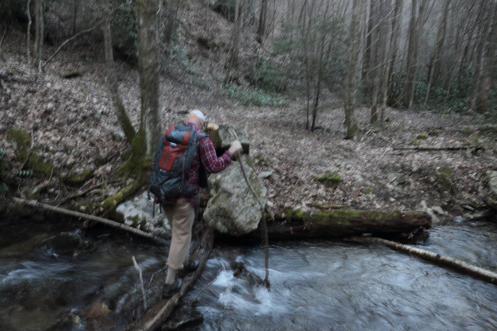
| Crossing Higgins Creek. |
 |
| Andrew can almost taste that pizza...what a day! |


No comments:
Post a Comment