Tuesday, October 22, 2013

I spend about as much time on the road as I do on the trail when I visit some the entries I have listed. Although my heart lies firmly in the mountains of North Carolina, my home state of Virginia has some wonderful hiking opportunities. This past Sunday I took advantage of one of those hikes and spent the day revisiting one of my favorite fall destinations..
Heading up the mountain.

The Brumley Mountain Trail is a fourteen mile combination of forest roads and narrow paths that wind up and across the mountain and toward Hidden Valley Lake. Along the way the trail passes the Channels of Virginia, a large outcrop of sandstone boulders that have mazes carved in them after years of water erosion. I had been several times and had enlisted some friends that live in the area to keep their eyes on the mountain in hopes of hitting the trail at peak fall color.
The Brumley Mountain Trail.
Reflection in a mud puddle on the trail.
Vines growing together in one of the clearings.

Sunday morning arrived and the group of coworkers I had arranged to hike with met at one of our stores in Abingdon, Virginia. Shane had text me earlier in the morning promising a surprise for the hike and I was anxious to see what he had up his sleeve. Just before we departed for the mountain, our company CEO arrived to hike with us as well! I will admit, I was definitely surprised but I also felt a great deal of pride that the owner of the company I work for was willing to join his employees for a day in the mountains.
Sherrell, Kip, and Shane nearing the fire tower.
Amber climbing the tower and the abandoned cabin in the background.

In all, seventeen of us made the journey to the trail head saddled on the Washington County/Russell County line off VA 80. The parking lot at the mountaintop was jammed with cars which wasn't surprising considering it was the first clear day we had really had that week. The trail follows an old forest road up the mountain for three miles passing several steep inclines near the summit and before the fire tower. The Hayter's Gap Fire Tower was built in 1939 and has long since been abandoned having the bottom rung of steps removed for safety reasons. As the group rested, I boosted Amber onto the tower and she took my camera up for some shots of the surrounding area. Here's one of the better photos she got from the fire tower.
Russell County view from Brumley Mountain.

The entrance to the Channels is also at the base of the fire tower and the trail winds through some rhododendrons before it splits with a small spur leading to the top of the boulders and the main trail continuing down into the boulder field itself. We all spent time on top of the Channels taking pictures and naming the distant ridges. However, the real fun is when you actually enter the Channels from the base. The towering boulders made even me feel small and everyone dispersed quickly making our large group vanish in the maze of sandstone. Although the group was large, the massiveness of Channels made it easy to get photos without anyone else in the shot. After about an hour of wandering through the maze, we reconvened at the fire tower and began the hike out. The sun was lighting the leaves perfectly so Amber and I lagged behind the group as I took countless photos.
Heading into the Channels.
Amber and Cash through the squeeze.
Over two acres of boulders to play in.

It was a surreal day hiking with my friends and coworkers, everyone seemed to have a good time and no one got hurt. I was impressed with the hiking prowess shown by my CEO and was thrilled when said he would love to join us on future hikes. Maybe I can interest him in some real estate in North Carolina. Until then, happy trails!
Our group.
Leaving Brumley Mountain.

Friday, October 18, 2013

Steve and I spent yesterday wandering through the Linville Gorge and riding the Blue Ridge Parkway. The fall colors are starting to peak in the high country of western North Carolina and our mission was simple; get as many good pictures of the mountains as possible.

Unfortunately, mother nature didn't receive our memo and the overcast skies sent us scrambling for a back up plan. The beautiful thing about cloudy days is that it makes for perfect waterfall photography. Yesterday morning, I got up early and researched my guidebooks for a few waterfalls to kill our day in the mountains on. Steve has been obsessed with completing the Carolina Waterfall 100 Challenge and there was only one waterfall left in the Grandfather Mountain section of the list, Steels Creek.
Forest road to Steels Creek.

Steels Creek for one reason or another has been overlooked by me and many other people as there are larger and more accessible falls on and along the Blue Ridge Parkway. The trip to the trail head is an adventure in itself, a four mile narrow dirt road ride with steep drop offs and no room for passing was a blast for me, for Steve, sheer terror. (my driving didn't help) When we arrived at the parking lot at the end of the forest road, I fully expected him to jump out and kiss the ground. The trail continues past the dead end in the road and around a few jeep mounds as it parallels Steels Creek. Soon you pass through a camp site that is littered with beer cans and other trash left behind by idiots. A few yards further there is a wonderful swimming hole on the creek below a small cascade. The trail crosses around the pool and above the cascade through the creek. This section could prove difficult in high water or for the average hiker. After crossing the creek the trail comes a T intersection with the Mountains to Sea Trail.
Crossing Steels Creek.
Snake swimming in the deep pool below the cascade.

The Mountains to Sea Trail is the Appalachian Trail's red headed step brother. Although much smaller and less traveled, it passes through some of the most beautiful terrain you will find anywhere. In fact, the part of Steels Creek we were hiking is affectionately known as "God's Country." The trail gains elevation leaving the creek via some switch backs up the ridge but soon switches back down the mountain meeting the creek again at a sandy beach section. The trees were a mix of reds, yellows, oranges, and greens adding to the beauty of the hike. There is a sloped rock near the beach that has a white blaze on it that can be easily missed if you aren't careful. We climbed the rock and entered the woods, steeply climbing through a ravine that kind of zigzags you up a dry stream bed until the trail finally turns sharply right and around a sharp ridge.
This guy was really enjoying modeling for photos.

Once we passed over the ridge, we both could hear the roar of the waterfall. It's always one of my favorite times in the hike, the excitement of seeing something new and being so close, and both Steve and I always pick up the pace. We came to a sharp trail that I knew led to the base of the waterfall but I suggested we continue on since the MST crosses the top of the waterfall and I wanted to see the view from there. As we stepped out onto the rocks above the falls, the scene was surreal. Steels Creek crashes wildly down multiple drops and through crazy potholes carved in the rock, it's the ultimate playground! The rocks however, are deadly slick and one wrong move and you would take the 70ft trip to the bottom the hard way. I snapped off a few photos and we made it back to the scramble path to the base for some more pictures. As the trail arrives near the base of the falls I realized we were actually only halfway down the falls and that there was a major drop just below the rock we had to find a way out on to get a decent view. The rock is sloped at a steep angle toward the creek and a rope from a tree is there to help as you slide out further for views. I was able to crab walk down a crack in the boulder and scoot over to the brink of the major drop off but below the first section of the falls with all the potholes. IT WAS PERFECT! I sat in amazement of the views as Steve managed to somehow get himself in a bind trying to cross the creek and was in all fours and snapped me back to reality. He eventually regained his balance and joined me on my perch.
Top of the watefall, lower section hidden from view.
This boulder has fell and balanced perfectly. Awesome swimming hole underneath it, if you dare.
Upper drop of the waterfall on Steels Creek.
Deep pool below the last drop.

Steels Creek was indeed impressive, the rock cliffs, fall colors, and epic waterfall made for postcard like conditions. We spent over an hour sitting on the narrow rock here, daydreaming of next summer and coming back to wade the creek up to the base and explore the uncharted waterfalls upstream on Steels Creek that show up on Google Earth. Stay tuned until then, and happy trails!
This is the bottom half of the waterfall before the long wide cascade.

Bear activity.

Saturday, October 12, 2013

A couple of weeks ago, Steve and I ventured into the North Carolina mountains in search of a few waterfalls. Recently we discovered a waterfall challenge made by the Carolina Mountain club, and since then we have diligently worked to knock waterfalls off the list.
Fall on the Harper Creek Trail.
Little Lost Cove Cliffs.

The first stop of the day was just off the Blue Ridge Parkway on the Harper Creek Trail (HCT) near Morganton. South Harper Creek Falls is over 200ft high and lies in a steep gorge surrounded by cliffs. The HCT starts relatively level and follows a ridge line as it makes it way toward the sound of water. The trail switchbacks down meeting the creek near the top of the waterfall, from here you have a couple of options. You can follow the creek downstream or cross and head toward the cliff overlook where you will have an entire view of the waterfall. We went downstream first and found a small spur trail that led us to the middle section of the waterfall and a flat rock before it flowed another 100ft off a steep grade. The whole area was pretty amazing and I even worked my way dangerously toward the lower drop to take a peek. Across the gorge the high cliff was visible where we would have to hike to see the whole waterfall. The upper section of the falls is shaded nicely by the cliff on the left side of the creek and a crystal clear pool made a tempting spot to take a dip. It was surprisingly hot with the sun bouncing off the rocks and I noticed that a few clouds were drifting in and decided we need to move to the cliff overlook for some pictures when the sun would be blocked by them. We followed the trail back upstream and crossed the creek, at the crossing a nice waterfall is visible upstream being roughly 30ft high. An obvious trail leads upstream toward it's base but we were greeted by no trespassing signs. I didn't let the sign discourage me and just waded out in the creek and upstream to take a few pictures.
Steve at the middle section of South Harper Creek Falls.

Steve and I continued back downstream on the main trail and began the climb toward the cliffs via switchbacks in the trail. We gained a lot of elevation very quickly and soon we were following the rutted path down to the cliff's edge. There are no safety devices of any kind here, so use your own judgement on how far out on the rock you want to go for the picture, a fall would most definitely be fatal. Steve scooted out to the edge first and called for me to join him. I took a more cautious approach and slowly scooted down to where I could see the waterfall. It was quite a sight! Both drops were visible and the bottom drop vanished below us at the tree line just before it met the creek. The sun was my enemy as it was high in the sky and glaring badly off the water below. Steve and I sat patiently waiting for a cloud to eventually deflect light long enough for a few photos before packing up and heading out for the next waterfall.
The cliff view at South Harper Creek Falls.
South Harper Creek Falls over 200ft high.

Harper Creek Falls would seem like it would be close considering we were on the Harper Creek Trail and at South Harper Creek Falls. However, to get to the trail head for our next waterfall we had to take a twenty minute car ride further down highway 181. Harper Creek Falls lies in the Wilson Creek Gorge off of 181. The drive into the gorge is beautiful and lots of great swimming holes and cascades line the creek. If I ever buy a kayak it will be the first place I bring it. As we arrived at the trail head the parking lot was jammed with cars, and we got the only available parking place. I was a little discouraged thinking it would be hard to get photos with people all over the waterfall. Kevin Adam's book describes the trail as a "gentle ascent" to the ridge line, rarely do I disagree with him, but the trail was anything but gentle as it rose quickly and winded both Steve and I as we mercifully made the ridge line. From there the trail began a long downhill grade before meeting the creek. The trail is a little confusing with lots of side paths cutting off in both directions but we stayed with the main route just following it upstream. Steve took a couple of memorable and hilarious falls as we were hiking this section and I had to bite my tongue from laughing too hard at his misfortune.
Cascade on Wilson Creek and deep channel below.

Eventually we arrived at a large worn path leading straight downhill with ropes tied off on a steep rock face. We had arrived at the base of Harper Creek Falls. The trail continued on upstream so I wanted to investigate before I took the steep trail down to see if there was a better route. I could see the waterfall down through the trees but it was way to steep to go down any way but the rope route. As we hiked back, I heard someone yelling for help. It was kind of surprising considering a hiker we had met told us we were going to be the only ones at the waterfall as they were hiking out. Again, I heard a female yelling for help coming from the bottom of the falls. Steve and I scrambled down the trail and found a girl and her dog trapped at the base of the large rope section up the steep rock. I took the rope and climbed down to where she was while Steve waited on me at the top. The dog was too old to scramble up the rock face and she was too weak to lift up the rock. I let the dog sniff my hand before I tried picking it up and handing it to Steve. Snickers the dog, wasn't a fan of this approach and growled at me so I moved down the rock further giving the dog more room while Steve and another good Samaritan called for Snickers to come to them. When the dog finally made a running attempt at the rock, I got behind it and pushed it on to the top. Both the dog and owner seemed grateful, and Steve and I stepped out on the rock at the base to the surprise of a much better waterfall than we were anticipating. The waterfall fell in three sections, the upper section was hidden from our view and the middle section slide sharply and pooled before going over the lower drop into a massive deep swimming hole. We indeed had the whole place to ourselves and the sun was finally far enough out of the sky for good photos. Steve suggested we hike around the pool and get up to the middle section for some better views. It's a steep climb up the domed shape rock at the base and one wrong step and you will be sliding into the pool whether you want to or not. A large rock rests at the drop of the middle falls and helped boost Steve onto it for better views. I waded the creek here and there is thick moss that makes traction a lot easier so I could photo the upper drop as well.
Harper Creek Falls.

Both of us hung out here soaking in the days accomplishments. We had knocked two waterfalls off our list and had a good time while doing it. We both decided when summer comes around again we would come back to the Wilson Creek Gorge for further exploration and swimming. Enjoy the photos, and until next time, happy trails!

Friday, September 20, 2013

After a thrilling visit to Flat Creek Falls and seven tough miles of hiking, both Steve and I were slightly winded. However, we couldn't pass up the chance to see another beautiful waterfall just down the road. Back on highway 281 and just past the Wolf Creek Dam is Paradise Falls.

Paradise Falls is just a short distance below the dam and with the unannounced release of water from the reservoir above, you are really putting yourself in harms way by visiting the base of the waterfall. The swimming hole below the falls is a popular place for local college students from Western Carolina, and two of them were killed when the water rose too rapidly for them to reach safety just a few years back. The flow of the waterfall is normally a trickle with the stream being controlled by the dam but with it being a really rainy summer we had our hopes up of seeing it with somewhat of a heavier flow.
Steve eating bread and approaching danger.

The parking for the falls is in a wide pull off in a curve off 281 near a white church. A large sign greets you at the trail head stating "DANGER: WATER LEVELS CAN CHANGE" from there the trail descends steeply reaching the stream. We were unsure where to go but I noticed the trail on the other side of the creek and we followed it steeply up the other side of the bank to where it leveled on a sharp ridge. The unmistakable sound of a waterfall greeted us and I saw a trail that went straight down. For those of you familiar with Compression and Twisted Falls trails, well this one was actually worse. There are points on the trail where it is hand over hand climbing (similar to using a ladder) made of tree roots and rock ledges. The roar of the water had me convinced that we had picked the right day to view the falls, because there was no way a trickle could make that much noise. As we nervously scaled down toward the base, I was mesmerized by the deep green pool. I had been having trouble with my hip and it was on fire from our first hike so some cold mountain water looked like the perfect cure. We soon reached the base, but the falls are hidden from two large boulders that stagger in front of the base. Crossing the creek isn't easy either, the bed is worn from years of water erosion and foot traffic on the rock at the base of the pool. Once I crossed though, I was greeted with the wonderful sight of Paradise Falls flowing at full blast.
Paradise Falls.
Another view of the falls.

Steve and I both were taken by surprise of the beauty of the falls because we had only looked at pictures of it with a trickle running off. I took picture after picture and eventually lowered my ailing hip into the cold pool at the base. The water was stinging cold but soon I was numb and my hip was off of my mind enough for me to climb out of the steep trail. As I looked around the area I could see signs of how high the water gets when they release it from the reservoir and it was a little unsettling as I sat in the pool below the falls. I convinced Steve to head out and we both gasped and grunted our way back to the truck.
Steve resting by the pool at the base of the falls.
Natural therapy.

Paradise Falls is aptly named, it truly has a feeling of paradise. The unique surrounding boulders and deep pool separate it from most waterfalls as well. It's a very short but strenuous hike but can easily be done if you just use caution and care, just remember not to let your guard down when you get to the base because you aren't out of harms way. Until next time, happy trails.
While looking through my North Carolina waterfall guidebook I found a picture of a beautiful massive waterfall across a distant gorge. As I read on excited to get the specific directions and find myself standing in that very spot, I was disappointed to learn that the author thought that it was far too dangerous to tell how to get there plus it involved trespassing which he couldn't condone. I was upset but not defeated.
The log foot bridge across flat creek.

I told Steve of the waterfall and that the directions weren't provided due to the fact that it's considered too dangerous. He immediately become obsessed with making the trip and I began work on finding some halfway reliable directions. I visited Waterfall Rich's site and he had bushwhacked down to the top of the falls by following the creek but mentioned a trip via old logging roads and after finding similar directions from SC Jack's page I decided it was close enough for me and Steve to hike to Flat Creek Falls.
Just beyond the dirt is a sharp drop to the creek.

Flat Creek Falls is over 200ft high and is in one of the more remote areas that we've hiked. Upon arriving at the trail head at the end of a forest road we were greeted with a maze of logging roads exiting in several directions. We were on the left side of Flat Creek and I noticed the wooden foot log across the creek and decided that was where we needed to go. Steve balanced him self carefully on the log bridge while I opted to wade through the ankle deep water. The old logging road meets a wide campsite in a few feet and we swung around the right side finding a path marked with a piece of flagging tape that looked like an old ATV route. There were big dirt mounds at the beginning of this trail and we stuck with it. Soon the trail become overgrown with laurel and was tough to wind through especially with my height but it was still obvious a lot of people had come this way. We kept swinging further away from Flat Creek and soon it was completely out of earshot. As we continued on, doubt began to creep into my mind that we were going in the wrong direction. Just as I thought we should turn back we met a logging road that had seen vehicle traffic. I had read to turn right at every intersection and so that's what we did. The logging road began to swing us back in the direction of Flat Creek so my spirits were lifted. Adding to my confidence was the occasional piece of flagging tape that we were heading toward something of importance. I was unsure if we were on private property but figured there wasn't logging roads on national forest land so I stayed quite as we wound around the ridges. Soon I saw a large orange blaze and flagging tape tied to a tree on the right of the logging road. A narrow worn path struck out toward a vast opening on the horizon, and I knew we were heading to the top of Flat Creek Falls. After a few feet I could hear the roar of water. The trail started dropping sharply toward the sound and I picked up the pace but was almost stopped in my tracks when I saw the danger ahead. We were indeed at the top of the falls but we were also about fifty feet above a sharp drop off down to water level and there were no good angles for photos. Steve scaled down closer to the main drop but slid in the loose dirt and rock and almost fell to his death before quickly retreating.
Only person I know that can almost die and smile about it.

We sat in the edge of the woods taking in the danger that surrounded us and decided we had to get to the base. We couldn't get there from any route that we could see from where we were at so I told him if we went back to the logging road that I thought it would swing us wide of the cliffs and we could scramble to the base when we got close enough to the creek. We hiked back to the logging road and took a right heading around the steep ridge and soon the logging road began to switchback down the mountain. We were going toward the base! I noticed a forest property sign on the right side and realized we had been on private property although none of it was posted. Soon we met another switchback but in the corner of the turn there was flagging tape and red blazes on the trees. It was the base spur trail. The trail however doesn't get any easier being steep and lined with my personal favorite of trail obstacles, stinging weeds. When we reached the creek, there was several paths to chose from so we crossed the creek and stuck with the most obvious way heading upstream.
The bright opening in the distance is the base of the falls.

About half a mile of creek crossing and bushwhacking later I saw a small cascade and a large opening upstream and could tell I had almost made it to the base. Steve was in front of me and made it to the view of the main drop first almost falling on his face as he stared up at it's size. I was more cautious carrying my camera bag and cell phone, jumping from rock to rock. When I finally joined him at his perch on a large rock, I too was in awe. Flat Creek was at a deafening roar and mist blew wildly from the water crashing from the drop. I was thrilled with it all, even with the sun being over the falls I was still able to take photos and Steve climbed the side of the falls for a closer vantage point. As far as a "wow" factor goes this falls is a 10, pictures can't translate it's sheer massiveness and just overall awesome surroundings. In my mind, it ranks up there with Virgin Falls as one of my all time favorites. Steve and I spent over an hour at the base raving about the greatness before us, before agreeing to come back later in the year when the leaves begin to change.
Flat Creek Falls.
This is over 100ft high. Unreal in person.

Sadly, Flat Creek Falls is not for everyone. It's a long and strenuous hike over dangerous terrain. Honestly there shouldn't even be a trail to the top of the falls because there is no place for pictures and any fall from there would most likely be fatal. Although the base is less than half of the total waterfall it is still as stunning as I have seen or most likely will ever see. Hopefully I can at least do this wonderful giant a little justice with this entry, until next time, happy trails.
This butterfly had no fear of me at all.

Thursday, August 22, 2013

Twisted and Compression Falls are separated by a half mile stretch of river. A half mile in the grand scheme of things seems like such a small distance, but for photography and all the camera equipment involved it is the most difficult of terrains. Compression Falls alone presents many challenges. The trail to the river is a vertical and I mean a vertical descent. It's the kind of trail that you use as a difficulty scale on all other hikes, but don't let your guard down when you reach the river, there is plenty more treachery ahead.
This is the view you have of Compression Falls when the trail reaches the river.

Once at the river, Compression Falls is visible upstream. There's an obvious trail leading up toward the base of the falls but it's strewn with boulders and tree roots, all of which could easily break an ankle. Just before the falls a large slab of rock shields you from getting an obstructed view of the entire thing, add the massive spray zone from the falls and it's a troubling thought for camera owners. I use a water resistant camera bag cover and usually opt to wade the river around the boulder using a narrow ledge along a deep pool to work my way eventually onto the rock slab and a full view of Compression Falls. The falls photograph well especially in cloud cover,  it also increases the odds that people won't be swarming all over the place as Compression is a wildly popular swimming hole. To keep going upstream you must cross the river at the base of the falls and the bedrock here is slick from years of water erosion. If you make it without being swept over the shoals downstream, a difficult cliff climb awaits to make it to the top of the falls. The top of Compression Falls is one of my favorite places I've ever been. The view downstream is beautiful and a large deep narrow channel runs to the base of about a twenty foot waterfall upstream.
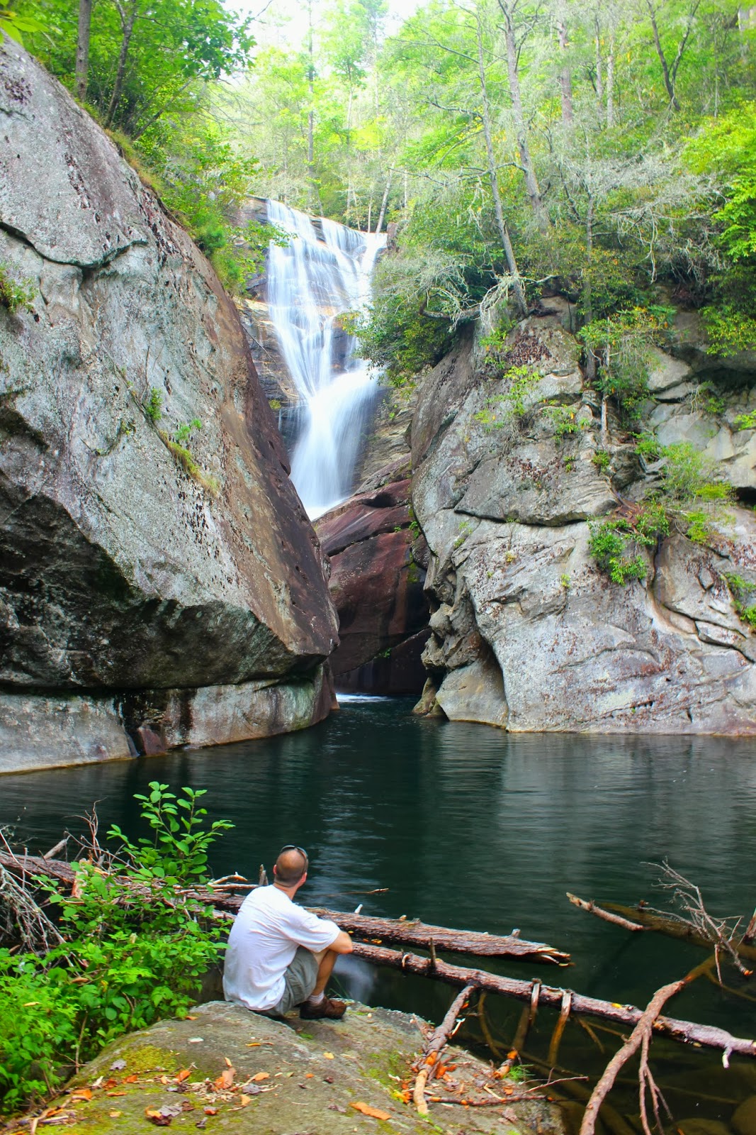
Compression Falls.
I took this photo from my knees in front of a cascade at the falls.

Sadly, this is as far as I've been upstream. Twisted Falls is still a quarter mile away and requires a river swim and rope climb up a rock wall to reach it's base, making it rarely photographed....UNTIL last Saturday.
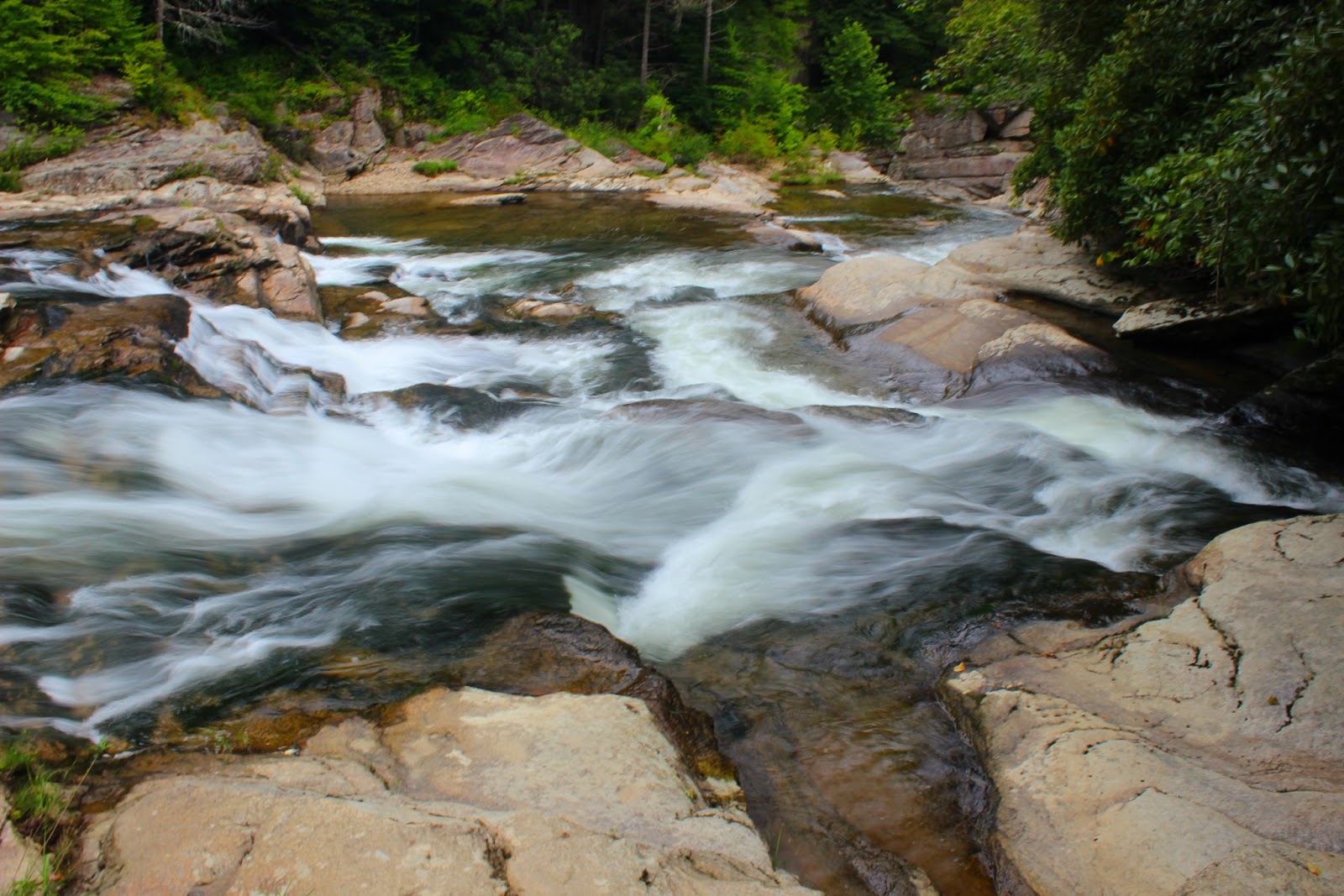
Cascades at Compression Falls.


Steve and I had both been on vacation the previous week but we didn't go on a single hike. A few months earlier, we had discovered a second steep descent to the river on the forest road above Compression Falls parking but had ran low on daylight and had to wait for another day. I found a blog post that described the trail and was delighted to find it also mentioned a "ninja trail" that leads to clear views of Twisted Falls for photographs from a cliff high above the river. A ninja trail is best described as a trail that's often hidden from view and many times dangerous to your health, and Steve and I would discover, that was correct on both accounts.

We arrived at the parking for Compression Falls which has seen major renovations with a nice large graded dirt parking lot. Unfortunately, it's also seen about forty straight days of rain and is rutted and ruined so we parked along the old forest road near the gate and started up toward the spur trail above Compression Falls.
The trail is a can't miss it's wide and rutted. It's just as steep as the other trail but there are trees and roots to use to help you along the way. The trail reaches the river at a very beautiful beach like area. Across the river a side stream enters via a 30ft waterfall, a wonderful treat and bonus falls! Downstream the river picks up steam as it nears the top of Twisted Falls. We wound down the bank beating our way through laurel and driftwood. Lots of nice cascades are in this section and a large shelf falls dropping the river about 10ft as it roars toward the boulders that \pinch or should I say "twist" the river through the falls. The trail dead ends at a large sloped rock that is angled toward the river. The rock was dry so we were able to walk along it closer toward the top of the waterfall. A large slab of rock waist high has to be negotiated here and I went first making it on top of it, and as I slid off the back side I used a small bush to steady myself and was immediately greeted with a burning sensation just under my arm. I turned and got another swift burn to my head! BEES! I unleashed a torrent of colorful language warning Steve of the danger still unware that I held the very limb that had the hornets attached to it. I decided as I danced wildly along the cliff my best course of action would be to retreat into the woods. As I scrambled back up the rock, I used the same branch as a hand hold once again and was lit up on my legs a few more times for good measure. Steve meanwhile laughed hysterically at seeing me in my misery from a safe distance downstream. When I made the edge of the woods, my feet flew out from under me and I got to bash my face on the rock as well. I crawled into the woods as I could still hear the bees swarming me and met yet another obstacle, thorn bushes. I shredded through them as they shredded through my arms and legs before I mercifully found a clearing to ditch my gear and roll around to make sure there weren't any strays in my clothes. Steve joined me a short time later and was still laughing at seeing that hornets nest shake wildly while I screamed in pain, he is after all, my best friend.
Side stream unnamed waterfall.

First Cascades nearing Twisted Falls.
Tricky spot requiring a hop to the next rock.
Made the jump, heading downstream.
The large shelf falls.
Shortly before I got in the hornets nest and getting higher on the rock.

In my terror and blindly thrashing through the woods, I had found our ninja trail. A faint narrow path travels uphill around a towering cliff at the top of Twisted Falls. Steve took the lead and we made it to the top to see that we were directly above a vertical drop to the river and the trail was foot in front of foot to swing around a rock that kind of stuck out about head level with me. Steve took a couple steps before one of the more terrifying things I've seen happened. He slipped with one leg completely kicking out the side of the cliff, he took his hand down to balance before scrambling around the danger. I felt my heart in my throat when I saw that happen and was amazed he regained his balance. He turned around only slightly rattled, looking at what might have been. I took my time and didn't have any problem making it although it made me very nervous. The trail gets a little better and winds deeper into the woods before swinging you out on the rocky cliff where you can finally see Twisted Falls. The rock cliff is sloped toward the river and a steep drop that would be fatal if you were to fall, so I scooted out to one of the only trees on the rock and kind of braced my foot on it while I worked to get pictures. The falls looked fantastic and I snapped photo after photo before making a few videos and packing up for the hike back out. Steve and I were stoked at our discovery and to be reunited on the trail. My hornet stings hurt but the satisfaction of what we had done outweighed my pain. We both vowed to come back and further explore the area when we had more time. The ninja trail continued down river and I'm sure we could make it connect with the Compression Falls trail. Until next time, happy trails.

Finally at the edge of the cliff.
Twisted Falls.
Last shot of Twisted Falls.