Stuck in line at the McDonald's drive thru wasn't how I wanted to start my day but apparently everyone in Cosby was hungry and I was inpatient as I had an epic day hike planned inside the park. John had drove ahead the night before since he usually works until midnight and car camped at the hikers parking lot in Cosby Campground. Sometime earlier that morning his stomach had cued his brain that he needed some chicken biscuits if he was going to stand on top of Mt. Guyot. The elderly lady at the window was friendly and noticed my pack in the seat next to me, "Are ya going hiking today?" she asked politely. "Yes ma'am, about 17 miles worth to Mt. Guyot." She looked puzzled and I knew the next sentence before she said, "I've never heard of Guyot, but you're gonna need more chicken biscuits, sweetie."
 |
| We knew it was going to be a long day but we were excited. |
 |
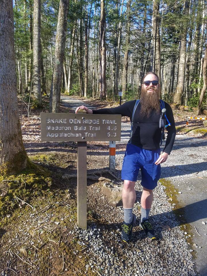
| Climbing Snake Den Ridge was slow going. |
Guyot came into my life in similar fashion. Looking for challenges and hikes is something of a hobby of mine and while reviewing the criteria to meet the South Beyond 6000 hiking challenge sponsored by the Carolina Mountain Club, I found mention of the the 4th highest peak on the Eastern seaboard and third highest peak in the park behind the crazy popular, Clingman's Dome and Mt. LeConte. I started researching the mountain immediately and found I had very little information to work through, apparently Guyot was a beast to tame. One of my favorite passages came from its description on a website called Summit Post which read: "Guyot is a lonely peak in the heart of an ancient range. The Summit itself is a tangled mass of fallen trees, thorny blueberry vines, and dead fir trees. It is an uninviting place whose beauty lies not in aesthetics but poetics; a timeless song of life, death, struggle, and rebirth making Guyot the very best of the Smoky Mountains." Instantly, I was in love with a mountain I had yet to lay eyes on.
Reading further articles, the tales of woe mounted with people taking as many as three and four unsuccessful attempts to locate the summit, some reaching the false summit to the west, only realizing their mistake after coming off the mountain. Perhaps I'm leaving the most crucial bit of information out, the summit of Guyot is without a trail.
 |
| Big switchback on Snake Den. |
 |
| Moss lined the trail as we climbed higher. |
The mountain was named for Arnold Guyot, the famed surveyor who measured the heights of many of today's mountains with scary accuracy considering the equipment available to him at the time. The inaccessibility of the mountain itself was daunting for early explorers and tales of their travels seemed to add to allure of it for me. Of course, I would have it much easier than they did because in 1934, a walking path was cut across it's western slope just a half mile shy of the true summit. Today that walking path is known as the Appalachian Trail.
I bet you're thinking, piece of cake, right? Well here's the kicker. The trail gets close to the summit but in between a nightmare approach of downfall and doubt make half a mile seem like three. BUT best of all, is the uphill nine mile march with a whopping 4900 feet in elevation gain coming out of Cosby Campground. John and I were gonna do this out and back, in a day.
 |
| Lunch time at the Appalachian Trail intersection with Snake Den Ridge. The breeze and higher elevation made me dig my coat out my pack. |
 |
| On the Appalachian Trail, we set our sights on Mt. Guyot, and the bonus peak, Old Black. (Guyot far left) |
Pulling into Cosby Campground I found John stretching outside of his car and tossed him his biscuits. The two hour drive down had my legs tight and I strolled over into the woods for some warm up and to rid myself of coffee. When I returned John had fished out some books he had picked up a few weeks earlier and one was Hikes in the Big South Fork. He said he had already read several passages in it and thought we should take a road trip there soon. Honestly, that's one of the things I like best about him, he's always looking at what's next. As much as I wanted to sit down with a map and the book and make plans, we had a monumental day ahead of us, so I checked my locks and started the GPS track on my watch. I started up through the campground looking for our first trail of the day, Snake Den Ridge.
The campground was still closed for the season so we followed through the paved road casually winding uphill until it met an old gravel road with the sign marking the official start of the day. My watch had .7 miles on it already when I glanced at it as I swung around the gate. The Snake Den Ridge Trail wastes little time and immediately starts a gradual climb lifting you out of the noise of civilization. Along the early stretch of trail we passed a small cemetery where a former Poet Laureate of the Smokies is laid to rest. For me, it was a wonderful spot to catch my breath, which reminds me; sometimes I don't think John is human. He zig zags all over the trail stopping and inspecting something before springing to his feet and taking off in a jog only to come to a stop as if he has a sudden thought and come back to walk along beside me before repeating this pattern, and at no time does he ever seem tired or out of breath. Meanwhile, I'm fidgeting with my pack straps, sucking down water, and breathing so loudly approaching hikers think they're about to bear witness to two animals mating. We're definitely an odd couple of hiking, Jesus and the Giant but we always have a wonderful time.
 |
| A small side trail takes you out to this open view of Mt. Sterling and the Big Creek section of the park. |
 |
| There's some rugged mountains to be tamed in this picture. Mt. Sterling is to the far left. |
It usually takes me a few miles to get my trail legs under me and when John paused at a fallen tree that looked perfect for a rest, I took time to shed my pack and look at the progress on his map and my watch. We had already passed a nice variety of wildflowers and could hear Inadu Creek on the horizon. The weather was perfect. Skies were clearing and the sunshine felt good with a slight breeze. Back to hiking we soon crossed Inadu Creek between two small waterfalls. John had read that it was the last sure water until Guyot Spring but both of us felt comfortable with our rations so I just dipped my hat in the icy water to cool my head. The trail stayed in a constant uphill grind and before long the sound of the creek was gone and only my breathing kept me company. At a sharp switchback, there was a wonderful view looking across to Mt. Cammerer but you really had to stretch out on a small cliff to see it. I snapped a few pictures and grabbed a quick drink before turning to see more uphill. The trail traveled a rocky finger like spur of the mountain and John and I both really enjoyed it. The views were sporadic but beautiful. The trail was really tough but switchbacks helped keep my legs churning and at times, I set our pace. I'll never forget when I hiked around a large boulder in a switchback to see a towering mountain ahead of me, it was my first view of Guyot. I had never seen it in a book or anything, but I KNEW it was Guyot. I stopped and pointed it out to John and he looked at his phone app to confirm. He stared at it briefly before looking up, "yep, that's it."
He didn't say it at the time, but the way his eyes drew down to a squint wrinkling his forehead as he looked at Guyot, I knew what he was thinking; we had a long way to go and all of it appeared to be uphill. Nevertheless, we settled in to a good pace as we hit more switchbacks that led us at a direction heading away from the mountain. Our small window of viewing it would be as close we would get it to it for the next couple of hours. We arrived at the Maddron Bald Trail intersection planning to drop packs and rest but the area was one giant spring with water seeping out of the ground and making the trail a muddy mess. The trail beyond the intersection was rocky and footing was tough but when we saw a group of hikers approaching from above our spirits were lifted. They said we were closing in on the Appalachian Trail and there was a perfect spot to rest. The next mile saw no sign of the AT but we did come across a level spot in the trail with a small campsite on the right. The sun lit the Grassy sides of the trail and I laid down using my pack as a headrest checking our progress on my watch, over 3000ft of climbing and over 6 miles in. The break may not have been necessary for John but it fixed my legs, for the remainder of the day I kept up.
 |
| Looking off the Cosby side of the mountain. This tree is the perfect point to leave the trail and head up to Old Black. |
 |
| Jesus doing some thinking before heading off trail. |
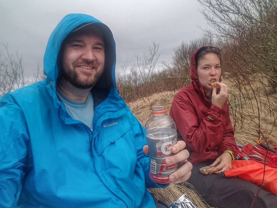
We arrived at the Appalachian Trail and found a nice rock to have lunch on. The wooden signs that make the park so great had the best news of the day carved deep on the first line: "Mt. Guyot 1.9 miles." Sitting still in the gap cooled me off in the breeze and broke out my jacket while I set up my hammock. There wasn't a great place to hang it but I fashioned it across the trail and settled in to some beef jerky and an apple pie meal replacement bar John was kind enough to share with me. The occasional hiker passed us by while we had lunch and each time, I jumped up and unclipped my hammock to let them pass. One group of three stopped with us asking what our plan for the day was, after telling them they acted quite surprised, their three day trip wouldn't equal our day hike mileage. I guess now is as good as time as any to reveal that John and I had a secret weapon that day. On his phone, he had a topo map with a small arrow pinpointing our exact location, there would be no way, we wouldn't reach the summit of Guyot. The plan was foolproof, we would hike the AT until we got close enough to jump off trail and run up to the summit, the beer in my pack was just begging to be cracked open in celebration!
 |
| John was an excellent navigator, only causing me to cuss mildly. |
 |
| It was tough but we knew we would be rewarded. |
It was also during lunch that I hit John with my surprise of the hike. Usually it's an extra mile of hiking, or a little underestimation of trail difficulty, but today, it was a bonus 6000ft peak! I told John along the way to Guyot, and since we were so close, we would knock out Old Black while we were at it. He looked down momentarily, and looked up with a clinched jaw before squeezing out, "you and your hiking lies." We both laughed but probably for different reasons before heading up the mountain. The stretch of Appalachian Trail from the Snake Den Ridge to Mt. Guyot is stunning. The first stop was an open view across to Mt. Sterling rising high above the Big Creek section of the park, but looming to our right was the round rise of Old Black with Mt.Guyot looming behind it. We had read of plane wreckage from a F4 Phantom but only located one piece that we felt was from a plane before deciding we missed the rest of it and would look for it on the return trip.
 |
| Seems like we might be reaching the peak! |
 |
| John looking for a higher point on Old Black but I had a secret from my vantage point... |
Closing in on Old Black, I kept John checking the GPS for our closest point to leave the trail to climb to the summit. We passed by an open view of the Cosby area with long views all the way back to the French Broad River and Douglas Lake. The dead trees that provided the view were hauntingly beautiful. (Authors note: this open view is the best spot to leave the trail for Old Black. The Appalachian Trail crosses a slab of flat rock that's insignificant but look uphill and start walking. You will broadside a small trail past a thicket of fir trees and can follow it twisting to the summit. I highly suggest the aid of a GPS device as well) Of course, John and I didn't know this at the time and continued on the trail a short distance not seeing any thing promising before stepping into a different world. Death and life collided with new growth fir and fallen giants coated in moss. John and picked our way over and under the obstacles following that little yellow arrow up. At times, he was only a few feet ahead of me but invisible behind thick branches of pine. Suddenly, I noticed obvious broken branches and the faintest of paths. I stopped John and told him we should follow it. We ended up snaking around a few obstacles but it was easier than what we had endured. A large tree was upended with its root system high in the air when I saw it. A small tattered American Flag hanging from the top of the roots. We had reached the summit of Old Black. John climbed on top of the jumble of fallen trees surveying the scene. It's a nice accomplishment but the view isn't the best, but being in such a wild spot was fantastic and now tantalizingly close was Mt. Guyot.
 |
| He was ON the summit of Old Black! |
 |
| We popped out back on the Appalachian Trail at this awesome view from earlier. |
We ended up following the faint path until it fizzled out above the fir thicket when I noticed the open view of Cosby and the dead trees that lined the Appalachian Trail, we popped out exactly on top of the flat rock I mentioned earlier. I can't describe to you how ecstatic I was from it all, and now a little less than a mile from standing on the mountain of my dreams. The Appalachian Trail vanishes into the darkness as giant firs line both sides of the trail as it climbs the western flank of Guyot. We passed a small spring with a white pipe emptying into a pool. John paused to fill his camelbak and had a genius idea. He had me fish out the two beers from my pack I had brought to toast our achievement with and stuck them in the icy spring to chill while he filtered the rest of his water. I laid on my pack staring at literally everything that was coated in thick bright green moss, it was if we had went back in time. When John finished his work, we studied the GPS one last time. It appeared we would intersect another spring a short distance later and that would be our exit point for the summit. We had hiked almost nine miles and were well above 4500ft in climbing for the day but my heart beat heavy not from exhaustion but with pure excitement.
 |
| Mt. Guyot is stunning. |
 |
| AT on Mt. Guyot. |
Leaving the trail, I almost felt guilty. The ground felt like I was walking on top of a mattress it was so thick with moss. I tried to tread lightly and picked my way uphill with John leading the way. We had purposely left the trail past the summit to hike at an angle backtracking upward to avoid stiff climbing and potentially getting steered toward the false summit area, and it's notorious torture chamber of downfall. Our plan worked well and we both paused at times just to enjoy the moment. We popped out on the ridge in a sea of fallen fir. The bark of the dead trees was bleached white from years of the sun beating down on it and I referred to it all all as the bone yard. The views off the mountain were far reaching and I couldn't help of think of the crowds that were Clingman's that day while we had an equally beautiful view all to ourselves. The climbing beyond that point was very slight but the going was slow. Some trees formed cages that we had to backtrack around. Thirty minutes passed with only a little progress. I snapped pictures wildly, knowing I may never return, so our pace didn't bother me. We ducked back into the forest with the trees being so thick the sun barely cut through and my pack rubbed when I walked between them. John bobbed and weaved along before announcing, "I see the summit marker." I was not far behind him but couldn't see it, it's that thick...seriously. he stopped just shy of the summit and stepped aside waiting for me to join him. He told me to go ahead so that I could be first but I told him we were a team and he earned it just like me, "go ahead, Jesus." He didn't realize it then, but it meant a lot to me that he would even do that. I've been blessed with quality friends to live out my dreams with me.
 |
| Heading up and into the bone yard of Mt. Guyot. |
 |
| I loved this area! |
The Summit marker is surrounded by a rock monument and we both hung our packs in the trees next to it and popped open the beer to celebrate. I hung my hammock beside the marker and kicked back enjoying the most refreshing beer of my life. John and I lingered at the summit for 30 minutes just making small talk and peering through the trees of the wildness of it all. Guyot was everything I could of hoped for and then some, it now stands firmly as the favorite mountain I have visited.
 |
| "I'd say Clingman's is crowded." |
 |
| One of my favorites from the bone yard. |
After finishing off the beer, I shoved the empties back in my pack, lifted it off the ground, and adjusted my straps for the nine mile downhill march to Cosby Campground. John suggested we drop over the side of the ridge and work our way downhill knowing we would broadside the Appalachian Trail along the way. Let me tell you, the climb off Guyot is as hard as the the climb up it! I actually found downhill harder with the moss wanting to give way easily under my feet. We came out right at the first spring we had cooled our beers in and started making some serious steps toward Cosby. We paused at some of the previous viewpoints along the way back as the afternoon sun lit the details of the ridges. Just before the Snake Den Ridge intersection we noticed some scraps of metal strung along the mountainside, it was the wreckage of the F4 Phantom. We scrambled down the trail and examined the pieces, careful not to disturb them of their final resting place. Two service members lost their lives in the crash so to me, it was hallowed ground. None of the pieces were larger than a ceiling tile, and the ground was bare of vegetation 30 years later.
 |
| Just when we were about beat, we reached the forest again. |
 |
| My first glimpse of the summit! |
 |
| Success! |
After the somber visit with the crash site we tore down Snake Den Ridge knowing darkness was now fast approaching. We limited our breaks and only stopped to adjust our packs or let our knees stop screaming momentarily. As the last light of the day faded, I saw the pavement of Cosby Campground, we were so close to 18 miles for the day, I actually passed the truck in the hikers lot and walked down to the Gabes Mountain trail head to reach 18.2 mile mark for one of the most epic trail days of my life. John and I shared a hug and a high five at the cars before tearing down the road to have a victory meal at Taco Bell.
 |
| Celebration on Guyot. |
 |
| F4 Phantom wreckage. |
 |
| John inspecting the crash site. |
The drive home was uneventful but my mind drifted back to the top of that mountain helping pass the time. The whole Guyot experience was wonderful. It was difficult, beautiful, and intimidating at times but I could now add conquered to that list. A few days later, I read an article on the toughest day hikes in the Smokies, strangely absent was Guyot. My guess was it was eliminated due to containing off trail hiking, but it inspired me nonetheless. Number one on the list was Baxter Creek to Mt. Sterling, the same mountain I gazed at from Inadu Knob and the same mountain I will climb in the morning. Until next time, happy trails.
 |
| Next stop, Cosby Campground! |
 |
| What a day! |